Utah Geological Survey
1594 W. North Temple
Salt Lake City, Utah 84116
Telephone: (801) 537-3300
Fax: (801) 537-3400
e-mail: kentbrown@utah.gov
The Mapping Program of the Utah Geological Survey (UGS) has attempted to scan and vectorize geologic maps of various types with mixed results. The software we used made workers frustrated with the amount of time required to vectorize a map, and the editing tools were inefficient and not user friendly.
In an effort to minimize our table digitizing and increase efficiency and positional accuracy, we evaluated five commercially available vectorizing programs. There was no real scientific method to our evaluation. We downloaded trial versions of the software and vectorized the same map using each application. Although these applications are also capable of heads-up digitizing and interactive vectorizing (line following), the focus of this test was to autovectorize the entire map. This paper summarizes the autovectorization process using R2V from Able Software Corporation.
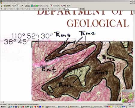
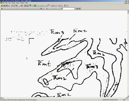
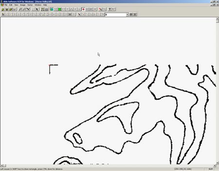
The JPEG files were opened in R2V (Figure 1), and a process was used to eliminate the colors, preserving just the black line features from the author's original mapping. Because the base-map features were colored over with pencil, the software did not interpret them as black and they could be eliminated almost entirely, leaving the inked contacts, faults, labels, and leader lines (Figure 2). Further image editing was done (Figure 3) to eliminate the leader lines, labels, and any trace of the base map that remained.
|
Figure 1. JPEG of original map opened in R2V. |
|
Figure 2. Colors from the original have been removed. |
|
Figure 3. Only lines to be used for autovectorizing remain. |
Next, the autovectorizing tool was used. This tool traces the pixels on the raster, so the resulting vectors have a stair-step appearance with too many vertices. The "smooth lines" command was used to eliminate many of the vertices that were redundant, making the lines look better. Because R2V supports layer creation, we chose to separate geologic contacts and faults onto different layers for easier data management. After manually editing the whole map, the vectors were suitable for use in our GIS (Figure 4).

Figure 4. Vectors ready for export and use in GIS. Pixelation seen here is an artifact of the computer screen capture. |
The vectors were then georeferenced by placing control points on the corners of the quadrangle and assigning correct UTM coordinates to them. Georeferencing is the final step before the lines are exported as a DXF file. We chose DXF because the layers are preserved, saving much time in GIS by importing layers from the DXF and attributing the whole layer at once. If exported as a shapefile, all layers are combined into one and we find this to be less useful.