
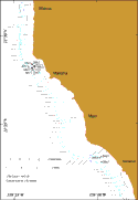
Home > metadata > vibracores > leeward coast
 |
Other info: |
| JULIAN DAY |
GMT (hour&min) |
RECOVERY (Y/N) |
ID NUMBER |
LATITUDE (north) |
LONGITUDE (west) |
WATER DEPTH (m) |
CORE LENGTH (cm) |
STUDY AREA |
|---|---|---|---|---|---|---|---|---|
| 179 | ? | N | 14V1 | 21.44517 | -158.21333 | 80 | - | Leeward coast |
| 180 | 0:07 | N | 15V1 | 21.47193 | -158.22974 | 23 | - | Leeward coast |
| 180 | 0:21 | N | 15V2 | 21.47173 | -158.22947 | 23 | - | Leeward coast |
| 180 | 0:41 | N | 16V1 | 21.47377 | -158.23181 | 24 | - | Leeward coast |
| 180 | 19:32 | Y | 17V1 | 21.47160 | -158.22934 | 23 | 285 | Leeward coast |
| 180 | 20:21 | N | 18V1 | 21.47009 | -158.23155 | 50 | - | Leeward coast |
| 181 | 17:39 | Y | 19V1 | 21.47048 | -158.23158 | 50 | 434 | Leeward coast |
| 181 | 18:23 | Y | 20V1 | 21.47350 | -158.23129 | 24 | 412 | Leeward coast |
| 181 | 19:14 | Y | 21V1 | 21.46843 | -158.23069 | 49 | 455 | Leeward coast |
| 182 | 20:07 | Y | 22V1 | 21.47070 | -158.23502 | 69 | 393 | Leeward coast |
| 182 | ? | N | 23V1 | 21.44517 | -158.21333 | 80 | - | Leeward coast |
| 182 | 22:38 | Y | 24V1 | 21.38642 | -158.16240 | 20 | 409 | Leeward coast |
| 182 | 23:38 | Y | 25V1 | 21.38542 | -158.16380 | 42 | 330 | Leeward coast |
| 183 | 0:27 | Y | 26V1 | 21.38128 | -158.16217 | 60 | 63 | Leeward coast |
|
Top of page
|
http://geopubs.wr.usgs.gov/open-file/of03-441/metadata/vibracores/leeward.html
For more information, please contact: Monty Hampton
Pages created and maintained by Laura Zink Torresan
last modified 15 December 2003 (cad)
USGS Privacy Statement | Disclaimer | Feedback | Accessibility
Department of the Interior U.S. Geological Survey Geologic Division
Coastal & Marine Geology Program Western Region Coastal & Marine Geology Team


