|
|
|
Home | Read-Me | Navigation | Profiles | Logs | Metadata | Software | Disclaimer | Acronyms
ARCHIVE OF CHIRP SEISMIC REFLECTION DATA
COLLECTED DURING USGS CRUISES 00SCC02
AND 00SCC04, BARATARIA BASIN, LOUISIANA,
MAY 12 - 31 AND JUNE 17 - JULY 2, 2000
by Karynna Calderon1, Shawn V. Dadisman1, Jack L. Kindinger1, James G. Flocks1,
Dana S. Wiese1, Mark Kulp2, Shea Penland2, Louis D. Britsch3, and Gregg R. Brooks4
1U.S. Geological Survey, St. Petersburg, FL 33701
2University of New Orleans, New Orleans, LA 70148
3U.S. Army Corps of Engineers, New Orleans District, New Orleans, LA 70118
4Eckerd College, St. Petersburg, FL 33711
U.S. Geological Survey Open-File Report 03-156
INTRODUCTION
Note: The web version of this archive does not contain the SEG-Y trace files. These files are very large and would require extremely long download times. To obtain the complete DVD archive, contact USGS Information Services at (888) ASK-USGS.
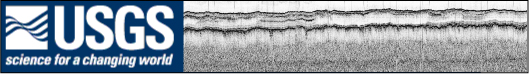
In May, June, and July of 2000, the U.S. Geological Survey (USGS), in cooperation with the U.S. Army Corps of Engineers, the University of New Orleans, the Louisiana Department of Natural Resources, and Eckerd College conducted a geophysical study of the Barataria Basin of southern Louisiana. This report serves as an archive of unprocessed digital seismic reflection data, trackline navigation files, shotpoint navigation maps, observers' logbooks, Geographic Information Systems (GIS) information, and formal Federal Geographic Data Committee (FGDC) metadata. In addition, a gained, digital Graphics Interchange Format (GIF) image of each seismic profile is provided. For convenience, a list of acronyms and abbreviations frequently used in this report has also been provided.
This Digital Versatile Disc (DVD) document is readable on any computing platform that has standard DVD driver software installed. Documentation on this DVD was produced using Hyper Text Markup Language (HTML) utilized by the World Wide Web (WWW) and allows the user to access the information using a web browser (i.e. Netscape, Internet Explorer). To access the information contained on these discs, open the 'index.htm' file located at the top level of each disc using a web browser. This report also contains WWW links to USGS collaborators and other agencies. These links are only accessible if access to the internet is available while viewing these DVDs.
The archived chirp seismic reflection data are in standard Society of Exploration Geophysicists (SEG) SEG-Y format (Barry et al., 1975) and may be downloaded for processing with public domain software such as Seismic Unix (SU), currently located at http://www.cwp.mines.edu/cwpcodes/index.html. Examples of SU processing scripts are provided in the chirpll.tar file located in the SU subfolder of the SOFTWARE folder located at the top level of each disc. In-house (USGS) DOS and Microsoft Windows compatible software for viewing SEG-Y headers—DUMPSEGY.EXE (Zilhman, 1992)—is provided in the USGS subfolder of the SOFTWARE folder. Processed profile images, shotpoint navigation maps, logbooks, and formal metadata may be viewed with a web browser.
ABSTRACT
This archive consists of two-dimensional marine seismic reflection profile data collected in the Barataria Basin of southern Louisiana. These data were acquired in May, June, and July of 2000 aboard the R/V G.K. Gilbert. Included here are data in a variety of formats including binary, American Standard Code for Information Interchange (ASCII), HTML, shapefiles, and GIF and Joint Photographic Experts Group (JPEG) images. Binary data are in SEG-Y format and may be downloaded for further processing or display. Reference maps and GIF images of the profiles may be viewed with a web browser. The GIS information provided here is compatible with Environmental Systems Research Institute (ESRI) GIS software.
PURPOSE
Marine seismic reflection data are used to image and map sedimentary and structural features of the seafloor and subsurface. These data are useful in mapping stratigraphy and in assessing other submarine geologic characteristics and features. These data were collected as part of a Louisiana Sand Resources Study done in cooperation with the U.S. Army Corps of Engineers, the University of New Orleans, the Louisiana Department of Natural Resources, and Eckerd College. This study is part of the USGS Subsidence and Coastal Change (SCC) Project.
SUPPLEMENTAL INFORMATION
The USGS Center for Coastal and Watershed Studies team in St. Petersburg, FL, assigns a unique identifier to all seismic data collected during each cruise or field activity. The method used to assign the identifier for the cruise or field activity is as follows: YYPRO##, where YY stands for the last 2 digits of the year in which the fieldwork is conducted; PRO is a 3-digit acronym for the project the data are collected for; and ## is a 2-digit event tag that represents a discreet leg or time period of fieldwork. Here, 00SCC02 tells us the data were collected in the year 2000 for the Subsidence and Coastal Change Project and that the data were collected during the second field activity for that project in that calendar year.
In order to conform to International Organization for Standardization (ISO) 9660 naming standards, the SEG-Y data files and associated navigation files were all renamed. Each trackline's original "bss" prefix was shortened to a single "b." For example, trackline "bss00c_01a" was renamed "b00c_01a."
Seismic reflection profiles are acquired by means of an acoustic source (usually generated electronically) and hydrophone or receiver arrays. Both elements are typically towed in the water behind a survey vessel. The sound source emits a short acoustic pulse that propagates through the water and sediment column. The acoustic energy is reflected at density boundaries (such as the seafloor or sediment layers beneath the seafloor) and detected at the receiver. This process is repeated at intervals ranging between 100 milliseconds (ms) and 1 second (s) depending on the seismic source employed. In this way, a two-dimensional vertical image of the geologic structure beneath the ship track is constructed.
The chirp system uses a source signal of continuously varying frequency. The seismic source employed consisted of an EdgeTech X-Star SB424 tow fish running Triton Elics FSSB software. The tow fish was routinely flown 2-5 m above the seafloor. Therefore, water depths shown on the chirp profiles are relative to the depth of the tow fish and not to sea level. Note that the raising or lowering of the tow fish during a survey (to avoid obstacles or follow relief) also produces a relative shift in the multiple reflections seen in the profile, which may be confused as a geologic feature. Any elevation change of the tow fish is recorded in the crew logbook. The fish was towed about 10 m behind the GPS antenna, and no correction for this offset has been made. The sample frequency of the data was 25 kilohertz (kHz), with a shot rate of every 0.25 s and a record length that varied between 20 and 32 ms. Refer to the GIF profile images for the exact record length of each trackline. Based on survey speeds of 3.5 - 4 knots, the shot spacing was about 0.5 m. For each recorded shot, three channels of data were collected. Channel 3 is the "real," or in-phase component of the signal, channel 2 is the "imaginary," or quadrative component of the signal, and channel 1 is the "envelope," or product of channels 2 and 3. Only channel 1 was used to produce the profiles presented here. However, all channels are included in the SEG-Y data files. No SEG-Y data exists for lines b00c_02, b00c_52, b00c_68 - b00c_72, and b00c_121 - b00c_124a. The original tracklines b00c_38, b00c_41, b00c_48, and b00c_66 were divided into b00c_38a and b; b00c_41a, b, and c; b00c_48a and b; and b00c_66a and b because the original total number of traces exceeds the maximum allowed by the processing system.
Seismic data were stored in SEG-Y format, which is a standard digital format that can be read and manipulated by most seismic processing software packages. The SEG-Y file format includes a 3,200-byte descriptive header that contains detailed information regarding the data acquisition and processing parameters. All data presented here are stored in SEG-Y, integer, Motorola format. The SEG-Y data files are too large to fit on one DVD, so they have been distributed onto four DVDs with the SEG-Y data files for lines b00c_01a - b00c_23 on Disc 1, lines b00c_24 - b00c_49 on Disc 2, lines b00c_50 - b00c_84 on Disc 3, and lines b00c_85 - b00c_120 on Disc 4. The SEG-Y formatted trace data files have a .TRA extension. Additional recording parameters for each seismic data file can also be found in the .PAR file associated with each .TRA file. However, the .PAR and .pln files are only needed to process or display the data with Triton Elics Delph Seismic software. These files are all stored in the SEGY folder located at the top level of these discs.
Note: The web version of this archive does not contain the SEG-Y trace files. These files are very large and would require extremely long download times. To obtain the complete DVD archive, contact USGS Information Services at (888) ASK-USGS.
Global Positioning System (GPS) navigation was provided to the acquisition system every second by a Trimble-Centurian P-Code receiver. The accuracy of this receiver is within 100 m. However, the data required some editing to remove spurious data values. The edited results were used to generate the trackline maps presented here. In addition, we have converted latitude and longitude to Zone 15 Universal Transverse Mercator (UTM) coordinates. The navigation data have not been corrected to reflect the 10 m offset between the source and the GPS antenna. No navigation was collected after shot number 447 for line b00c_28a or after shot number 3,915 for line b00c_28b. Position fixes for every 1,000 shots and for the starts of lines are also provided as an aid for registering of the data after plotting. All navigation files are stored as flat ASCII text files within the NAV folder located at the top level of each disc. Raw navigation files are stored in the RAWNAV subfolder, edited navigation files are stored in the EDITNAV subfolder, and 1,000-shot interval files are stored in the SHOTNAV subfolder.
The trackline maps provided in this archive are in geographic projection. They were created using ESRI GIS software ArcView 3.2, exported to Adobe Illustrator for further editing, and saved for the web in JPEG format. These JPEG images are viewable with a web browser and can be found in the MAPS folder located at the top level of each disc. Also included on each disc are the ESRI ArcView project and shapefiles used to create the trackline maps presented here. These can be found in the ARC subfolder of the SOFTWARE folder located at the top level of each disc. The project is compatible with ArcView 3.x (Unix, Windows) and ArcGIS 8.x (Windows). The shapefiles can also be viewed using public domain software ArcExplorer 2.0 (Windows) and 4.0 (Windows, Unix, Linux), which can currently be downloaded from the ESRI website at http://www.esri.com/software/arcexplorer/index.html.
Field Activity Collection System (FACS) logs are available in both HTML and Rich Text Format (RTF). They can be found in the FACS folder located at the top level of each disc. Scanned GIF images of the original handwritten logbooks are also provided and can be found in the LOGBOOKS folder located at the top level of each disc.
Also included on each disc are example Seismic Unix (SU) scripts that allow the user to strip off navigation fixes from the SEG-Y headers, along with a fix for every 1,000 shots, and produce a gained GIF image of each profile. These images can then be displayed using a variety of shareware programs such as ImageMagick (Unix, Linux) or a web browser. The example scripts are included in the chirpll.tar file located in the SU subfolder of the SOFTWARE folder located at the top level of these discs.
DISC CONTENTS
INDEX.htm: a home page for viewing this report using a WWW browser
DISCLAIM.rtf: the USGS disclaimer for this report in Rich Text Format
METADATA.rtf: formal FGDC metadata for the seismic reflection data and for the associated shotpoint navigation maps in Rich Text Format
README.rtf: a Rich Text Format version of this page
FACS Folder: contains the 00SCC02 and 00SCC04 subfolders
HTML Folder: contains all HTML documents used in this report, and JPEG images used by the HTML hyperlinks
LOGBOOKS Folder: contains the 00SCC02 and 00SCC04 subfolders
MAPS Folder: contains the 00SCC02 and 00SCC04 subfolders
NAV Folder: contains the EDITNAV, RAWNAV, and SHOTNAV subfolders
PROFILES Folder: contains the 00SCC02 and 00SCC04 subfolders
SEGY Folder: contains unprocessed digital seismic reflection data in SEG-Y format divided among four discs. Also included are the companion .PAR files and the cent_rmc.pln file used by Delph Seismic software to process or display the data.
Note: The web version of this archive does not contain the SEG-Y trace files. These files are very large and would require extremely long download times. To obtain the complete DVD archive, contact USGS Information Services at (888) ASK-USGS.
SOFTWARE Folder: contains the ARC, SU, and USGS subfolders
DISCLAIMER
This Digital Versatile Disc (DVD) publication was prepared by an agency of the United States Government. Neither the United States Government nor any agency thereof, nor any of their employees, make any warranty, expressed or implied, or assumes any legal liability or responsibility for the accuracy, completeness, or usefulness of any information, apparatus, product, or process disclosed in this report, or represents that its use would not infringe privately owned rights. Reference therein to any specific commercial product, process, or service by trade name, trademark, manufacturer, or otherwise does not necessarily constitute or imply its endorsement, recommendation, or favoring by the United States Government or any agency thereof. Any views and opinions of authors expressed herein do not necessarily state or reflect those of the United States Government or any agency thereof.
Although all data published on these DVDs have been used by the USGS, no warranty, expressed or implied, is made by the USGS as to the accuracy of the data and/or related materials and/or the functioning of the software. The act of distribution shall not constitute any such warranty, and no responsibility is assumed by the USGS in the use of these data or related materials.
ACKNOWLEGEMENTS
Funding and/or support for this study were provided by the Coastal and Marine Geology Program (CMGP) of the USGS, the U.S. Army Corps of Engineers, the University of New Orleans, the Louisiana Department of Natural Resources, and Eckerd College. We thank Chandra A. Dreher of the USGS in St. Petersburg, FL, and Allison Peters, Carlos Alonzo, and Mike Brown of the University of New Orleans in New Orleans, LA, for their field support during data collection. Boat captains Dave Bennett of Eckerd College in St. Petersburg, FL, and Richard W. Young and Keith A. Ludwig of the USGS in St. Petersburg, FL, also assisted in data collection. We thank Gina M. Peery of the USGS in St. Petersburg, FL, for her work as FACS coordinator. We also thank reviewers Dann K. Yobbi of the USGS in Tampa, FL, and John C. Brock of the USGS in St. Petersburg, FL, whose comments improved this document.
REFERENCES
Barry, R.M., Cavers, D.A., and Kneale, C.W., 1975, Recommended standards for digital tape formats: Geophysics, v. 40, p. 344-352.
Zihlman, F.N., 1992, DUMPSEGY V1.0: A program to examine the contents of SEG-Y disk-image seismic data: U.S. Geological Survey Open File 92-590.
Home | Read-Me | Navigation | Profiles | Logs | Metadata | Software | Disclaimer | Acronyms