|
|
|
Home | Read-Me | Navigation | Profiles | Logs | Metadata | Software | Disclaimer | Acronyms
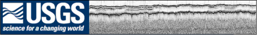
The following pages contain thumbnail images of all chirp seismic reflection profiles collected during USGS Cruises 00SCC02 and 00SCC04. To view a profile, click on the desired thumbnail, and a full-size version will appear. The profiles, which are stored as GIF images by trackline number, can also be found in the PROFILES folder located at the top level of each disc. The profiles presented here were produced using Seismic Unix software. Examples of the processing software are provided in the SOFTWARE folder located at the top level of each disc.
NOTE: Trace length varies greatly (20-32 ms) during these cruises. Please refer to the GIF profile images for the exact length of the trace.
NOTE: These data were not adjusted to compensate for the tow depth of the chirp fish. Only depth below seafloor is accurate. The depth of the seafloor is only relative to the depth of the towed fish.
NOTE: In order to conform to ISO 9660 naming standards, all tracklines have been renamed. Each trackline's original "bss" prefix was shortened to a single "b." For example, trackline "bss00c_01a" was renamed "b00c_01a."
Click on the links below for instructions on how to download the SEG-Y data files, a detailed description of the SEG-Y data format, and formal FGDC metadata for the seismic reflection data and accompanying shotpoint navigation maps.