U.S. Geological Survey Open-File Report 03-221
A Pictorial Survey of the Bedrock Beneath Western Cape
Cod, Massachusetts
|
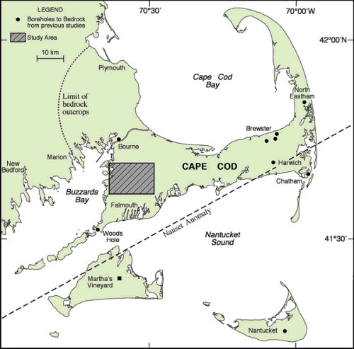
Map showing location of the study area and boreholes drilled to bedrock as part of earlier studies (Koteff and Cotton, 1962; Maevsky and Drake, 1963; unpublished. Well data, American Drilling and Boring Company, Inc., East Providence, RI, 1965; Folger and others, 1978; Leo and others, 1993). The Martha's Vineyard test well (which did not reach bedrock) is shown as a solid square (Hall and others, 1980). Figure also shows limit of bedrock outcrops and approximate location of Nauset Anomaly after Leo and others (1993). |