Link to USGS home page Link to USGS home page
Coastal and Marine Geology Program
Coastal & Marine Geology Program > Coastal Classification Mapping Project > Open File Report 03-227

Coastal Classification Atlas

West-Central Florida Coastal Classification Maps - Anclote Key to Venice Inlet

USGS Open File Report 03-227

Robert A. Morton, Russell L. Peterson

Report Home Maps Overview Mapping Methods Coastal Classifications Geologic Setting Coastal Processes Coastal Vulnerability Classification Summary References
Introduction || City: Tarpon Springs | Dunedin | Clearwater | Seminole | Pass-A-Grille Beach | Egmont Key | Anna Maria | Bradenton Beach | Sarasota | Bird Keys | Laurel | Venice
Area: Northwest | Southwest

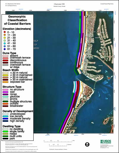
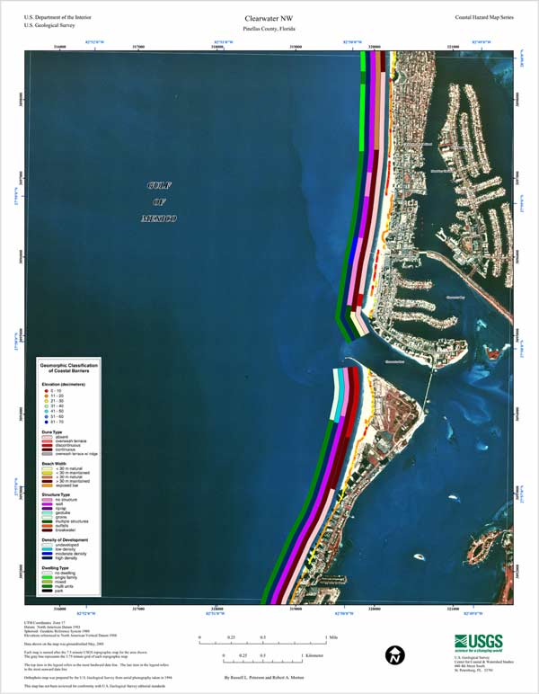
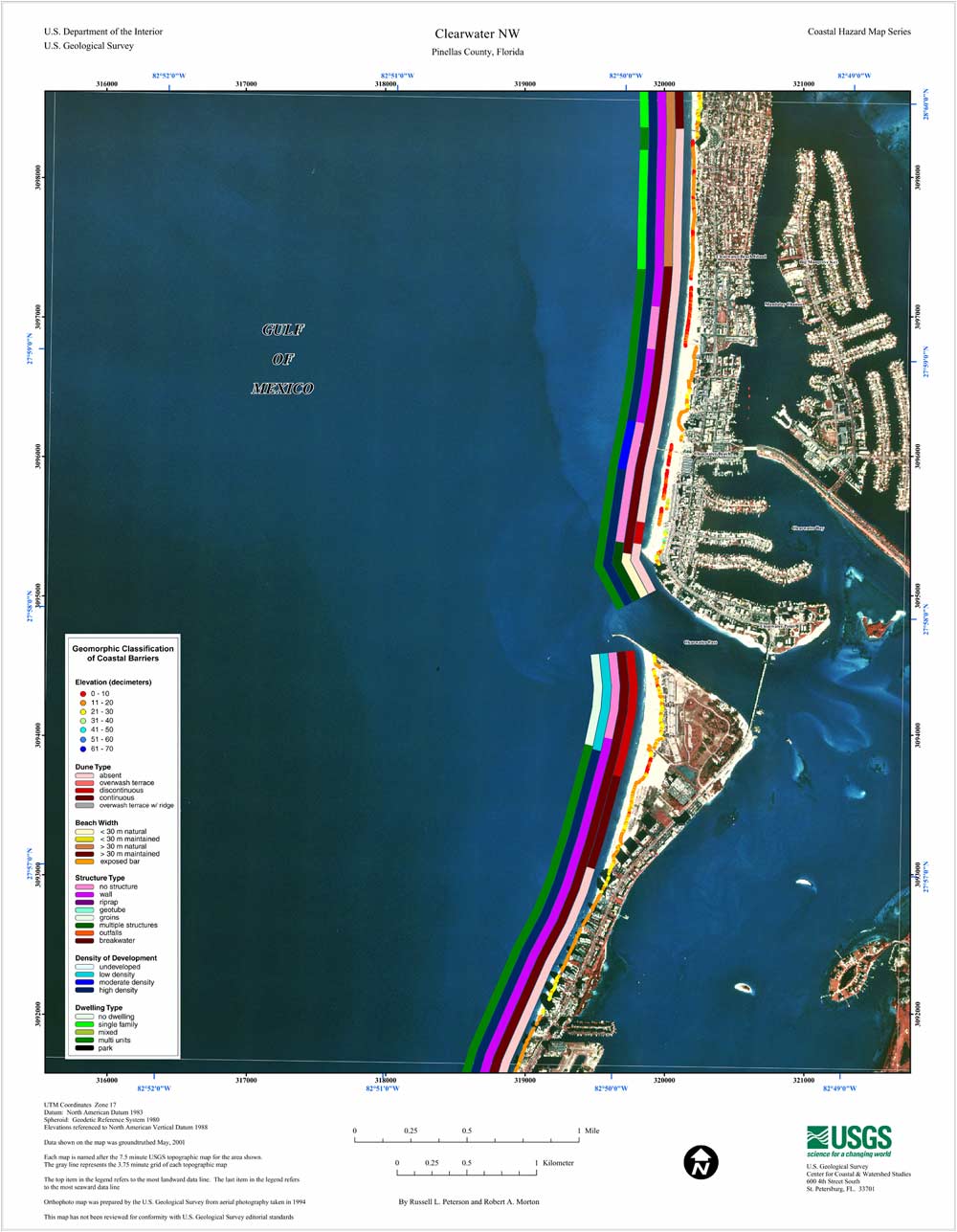
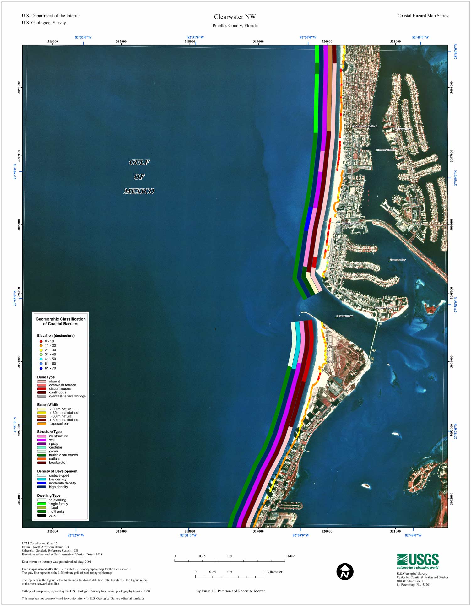
Clearwater NW Coastal Classification Map

Coastal Classification Map for Clearwater NW. Map showing the coastal classifications along the NW Clearwater shoreline. The top item in the legend refers to the most landward data line. The last item in the legend refers to the most seaward data line. Click on the links below to download and view larger versions of the map.

8 1/2" X 11" (52 KB JPEG)
14" X 18" (132 KB JPEG)
21" X 27" (264 KB JPEG)
  Printable PDF version (5.3 M PDF)
Can't see the PDF version?
Get Adobe Acrobat® Reader

Coastal Classification Map for Clearwater NW   index map, Clearwater NW selected
Clickable Index Map. Use the index map above to navigate to the different coastal areas. The selected area is outlined in red.

Bradenton Beach SEBradenton Beach NWBird Keys NEAnna Maria SWAnna Maria NWVenice NWLaurel SWSarasota SW/SESarasota NWEgmont Key NEPass-A-Grille Beach SWPass-A-Grille Beach NWPass-A-Grille Beach OE West NESeminole SW/SESeminole NWClearwater SWDunedin SWDunedin NWTarpon Springs SWTarpon Springs NW

Coastal & Marine Geology Program > Coastal Classification Mapping Project > Open File Report 03-227


[an error occurred while processing this directive]