High-resolution seismic-reflection surveys in the nearshore of outer Cape Cod, Massachusetts, USGS Open-File Report 03-235
Back to Title Page
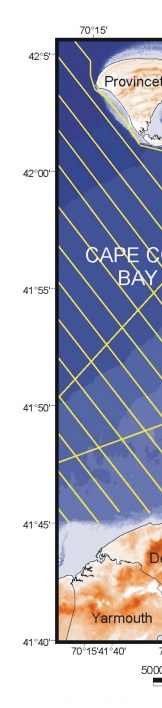
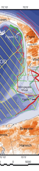
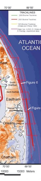
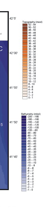
Figure 4. . Trackline map showing locations of Boomer subbottom profiles. Bold sections of tracklines indicate locations of seismic profiles in figure 5, figure 6, figure 11, and figure 12. Boomer tracklines from Oldale and O'Hara (1990) and USGS watergun profiles are shown. Topography is from USGS 3-arc second Digital Elevation Model. Bathymetry is from NOAA Coastal Relief Model (www.ngdc.noaa.gov/mgg/coastal/coastal.html).
Click on figure for larger image (PDF format 2500 KB).
 |
 |
 |
 |
![]() To view files in PDF format, download free copy of Adobe Acrobat Reader.
To view files in PDF format, download free copy of Adobe Acrobat Reader.
