USGS Open-File Report 03-254, High-Resolution Subsurface Imaging of Coastal Barriers
Back to
Main Page
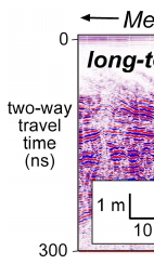
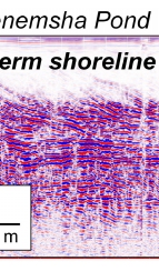
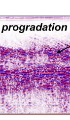
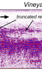
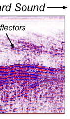
Figure 2. Shore-perpendicular GPR profile across the landward portion of Lobsterville Beach, Martha's Vineyard, Massachusetts. The long-term depositional trend, characterized by seaward-dipping reflections in the upper part of the record, is punctuated by episodes of erosion represented by truncated reflectors. The sequence shown here may represent several thousand years of coastal change.

|