Mapping the floor of Lake Mead (Nevada and Arizona): Preliminary discussion and GIS data release, USGS Open-File Report 03-320
OFR 03-320 DVD-ROM Contents Geologic Discussion
Contacts |
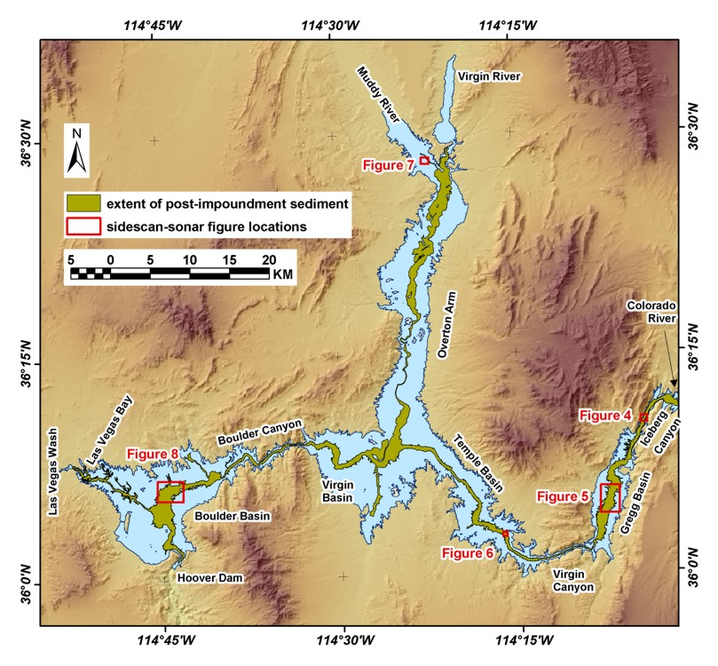
Figure 3. Click on each figure number to go to image. Extent of post-impoundment sediment in Lake Mead, and the locations of sidescan-sonar images shown in Figures 4-8.

Title Page / Contents / Discussion / GIS Data / Contacts
[an error occurred while processing this directive]