Digital Mapping Techniques '03
— Workshop Proceedings
U.S. Geological Survey Open-File
Report 03–471
Meeting Constituent Needs For 1:24,000 Scale Geoscience Data In New Jersey
New Jersey Geological Survey, P.O. Box 427, 29 Arctic Parkway, Trenton, NJ 08625-0427
Telephone (609) 292-2576; fa (609) 633-1004; email
ron.pristas@dep.state.nj.us
The New Jersey Geological Survey is distributing 1:24,000-scale geoscience data in three ways: traditional sales of hard copy maps through a Maps and Publications Sales Office, download of Open-File Map (OFM) and Geologic Map Series (GMS) maps from the Survey’s internet web page, and download of geographic information system-compatible map data sets. The three distribution methods the Survey uses meets our constituents’ needs by providing both hard copy and digital geoscience information.
At this time we have thirteen OFM and GMS maps available for download at http://www.nj.gov/dep/njgs/pricelst/njgsmaps.htm. The displayed maps (figures 1 and 2) are examples of the Open-File maps available for download as Adobe Acrobat portable document format (PDF) files.
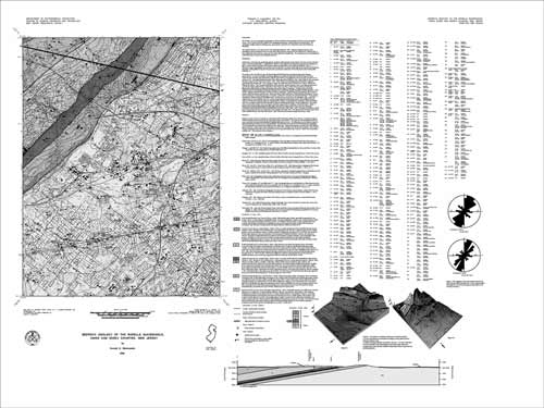 |
| Figure 1. Black and white copy of full-color map of the bedrock geology of the Roselle quadrangle (Monteverde, 2000). |
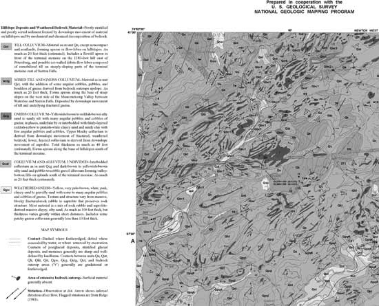 |
| Figure 2. Black and white copy of part of the full-color map of the surficial geology of the Tranquility quadrangle (Stanford, 2002). |
The GIS data sets of these two quadrangles are not yet available for download but may be obtained through a written request to the New Jersey State Geologist (karl.muessig@dep.state.nj.us). Several 1:24,0000-scale county data sets are available at http://www.nj.gov/dep/njgs/geodata/archive.htm.
REFERENCES
Monteverde, D. H., 2000, Bedrock geology of the Roselle quadrangle, Union and Essex Counties, New Jersey: New Jersey Geological Survey Open-File Map OFM 34, scale 1:24,000, PDF file, 2.0 MB.
Stanford, S. D., 2002, Surficial geology of the Tranquility quadrangle, Warren, Sussex, and Morris Counties, New Jersey: New Jersey Geological Survey Open-File Map OFM 51, scale 1:24,000, PDF file, 3.9 MB.