![]()
North Dakota Aeromagnetic and Gravity Maps and Data:
A Web Site for Distribution of Data
by
Ronald E. Sweeney and Patricia L. Hill
Open-File-Report 03-249
2003
North Dakota Merged Aeromagnetic Anomaly Map (NE illumination)
Continued to 1000 Feet Above Ground
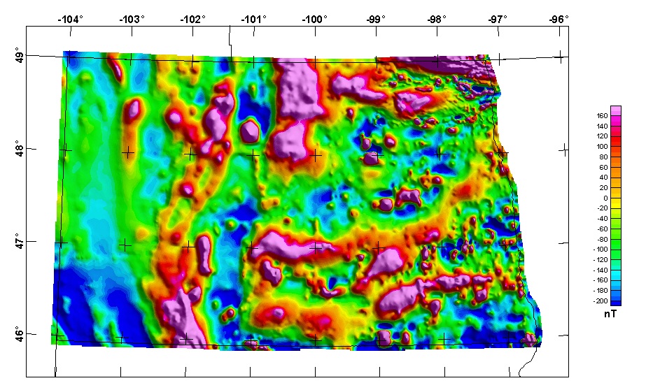
The grids for this map in various formats are available from the data directory as nd1000ag.***

Non-graphical version of this page.
AccessibilityFOIAPrivacyPolicies and Notices
![]()
For more information about this report contact: Ron Sweeney