|
|
|
|
|
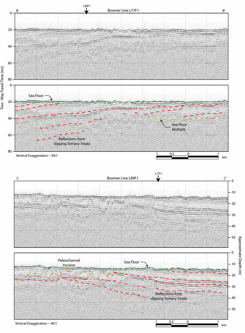
Figure 10. Processed boomer sub-bottom profiles with interpretations. These profiles provide both shore parallel (L77F1) and shore perpendicular (L89F1) images of the subsurface. These images illustrate the slight southerly dip of the Tertiary continental shelf strata underlying the area (Deeper Cretaceous strata are likely not imaged). Vertical scales for sub-bottom profiles are provided in both milliseconds (Two-Way Travel Time) and approximate depth in meters (assuming a seismic velocity of 1500 m/s). Locations for lines L77F1 and L89F1 are outlined in Figure 7.
|
Can't see the printable PDF version? Get the free Adobe Acrobat® Reader. |