
|
|
|
|
|
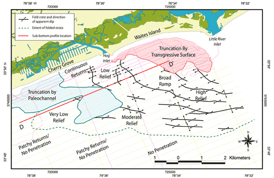
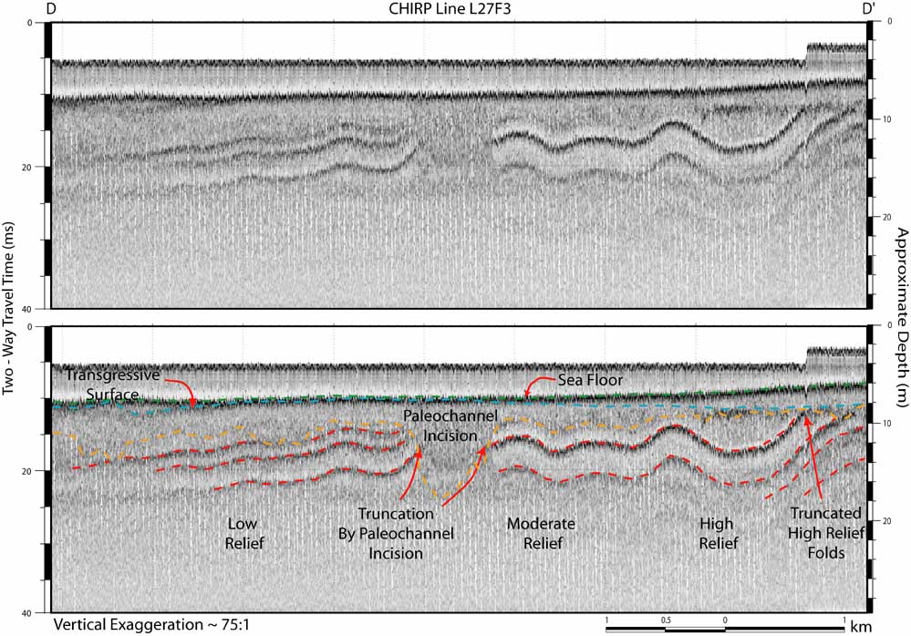
Figure 11. Generalized structure map (top, location outlined in Figure 7) of the nearshore portion of the study area from Cherry Grove to Little River Inlet, which illustrates the folded nature of underlying Cretaceous beds. Folding of this nature is observed throughout the study area, but is particularly prevalent at this location. Below, the CHIRP sub-bottom profile with interpretations (D - D', transect located on inset structure map) shows examples of the varying degrees of relief associated with the folded strata. Also illustrated are examples of folded strata being truncated by the transgressive unconformity, and by paleochannel incision. The high relief antiform structure in the central portion of the profile has been breached at its crest by a paleochannel incision. Thinning and fracturing of the strata at the crest of antiform structures could increase the likelihood of fluvial incision at that location. Vertical scales for sub-bottom profiles are provided in both milliseconds (Two-Way Travel Time) and approximate depth in meters (assuming a seismic velocity of 1500 m/s).
|
Can't see the printable PDF version? Get the free Adobe Acrobat® Reader. |
 |
 |