Link to USGS home page Link to USGS home page
Coastal and Marine Geology Program
Coastal & Marine Geology Program > South Carolina Coastal Erosion Study > Open File Report 2004-1013

Maps Showing the Stratigraphic Framework of South Carolina's Long Bay from Little River to Winyah Bay

USGS Open File Report 2004-1013

by: Wayne E. Baldwin, Robert A. Morton, Jane F. Denny, Shawn V. Dadisman, William C. Schwab, Paul T. Gayes, and Neal W. Driscoll

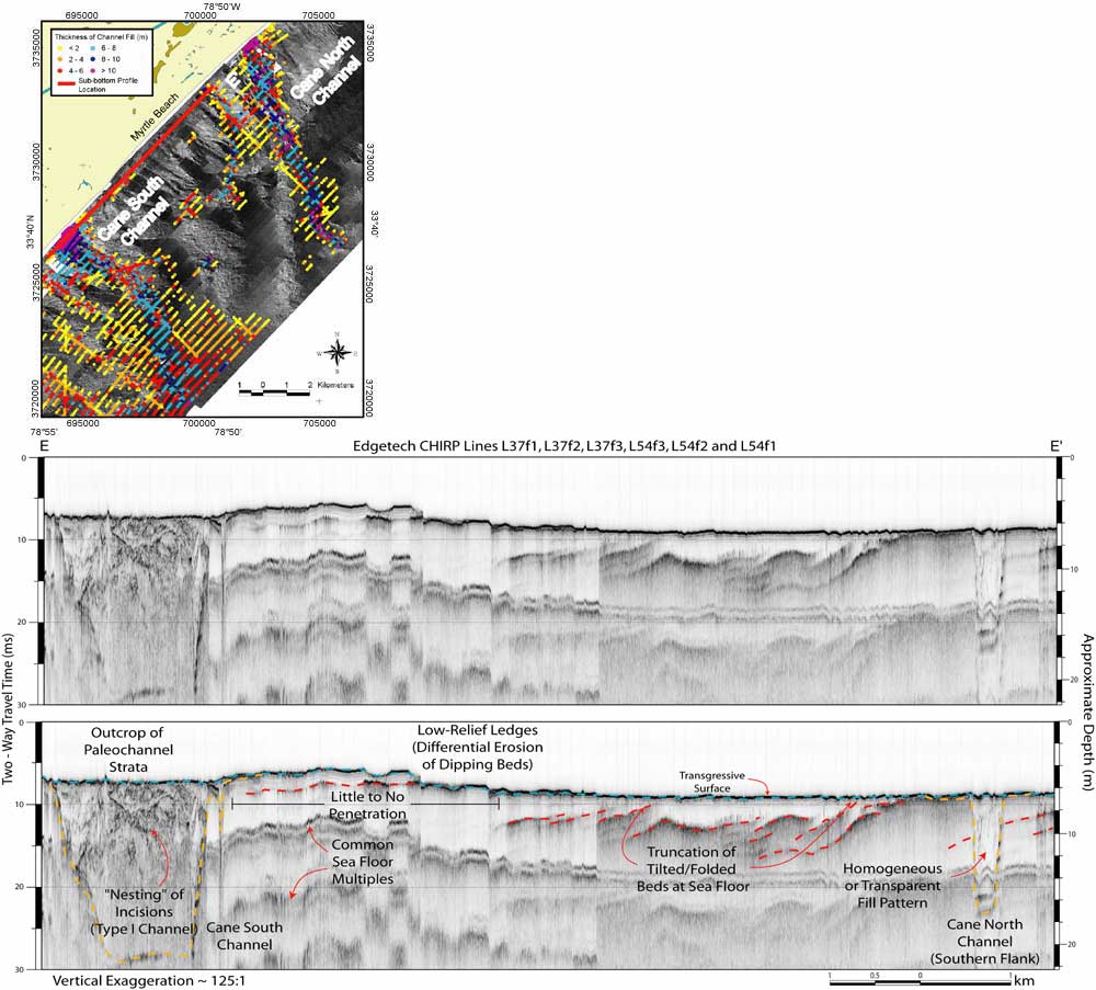
Figure 12. Sidescan-sonar coverage overlain by thickness of channel fill (top left, location outlined in Figure 7), showing the location and trends of the Cane North and Cane South channels. The composite CHIRP sub-bottom profile with interpretations (E - E') provides subsurface imagery of the two channel features along a nearshore transect (top left). The seismic example illustrates how cross-sectional morphology (including width and incision depth) and cross shelf morphologies of paleochannel incisions vary within the study area. Vertical scales for sub-bottom profiles are provided in both milliseconds (Two-Way Travel Time) and approximate depth in meters (assuming a seismic velocity of 1500 m/s).

Printable version of Figure 12.Printable Version of Fig. 12 (48 MB PDF)
Can't see the printable PDF version? Get the free Adobe Acrobat® Reader.

Sidescan-sonar coverage overlain by thickness of channel fill, showing the location and trends of the Cane North and Cane South channels.

Coastal & Marine Geology Program > South Carolina Coastal Erosion Study > Open File Report 2004-1013


[an error occurred while processing this directive]