|
|
|
|
|
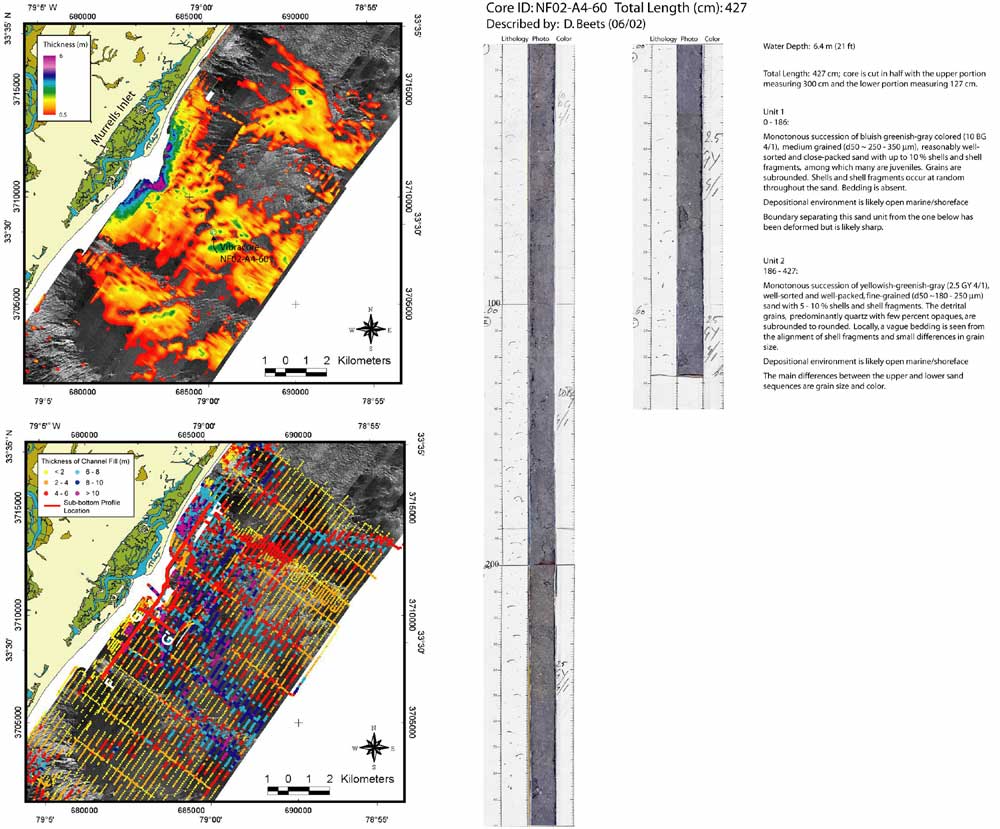
Figure 15. Sidescan-sonar coverage overlain by surficial sediment thickness grid (upper left, location outlined in Figure 7), showing the distribution of surficial sediment within the inner continental shelf offshore of Murrells Inlet. Sediment within the shoals is thickest (4 - 6 m) near the mouth of the inlet, and generally thins seaward. In several offshore locations however, localized accumulations exceed 3 m. Vibracore sample NF02-A4-60 (right, location upper left and in Figure 7) illustrates the type of sediment within the shoals, which is predominantly medium to fine grained sands containing ~ 10 % shell fragments. An ~ 1.5 m discrepancy in sediment thickness is indicated between the core sample and the thickness grid at this location. This may be due to sediment moving into the area between the times of acquisition (from '99 - '00 to '02), or inadequate resolution within the SIS-1000 sub-bottom data. Sidescan-sonar coverage overlain by thickness of channel fill (lower left, location outlined in Figure 7) illustrates the Murrells Inlet incised valley that underlies the inlet associated shoal complex. Channel incisions within this incised valley comprise a complex integrated drainage network with multiple thalweg features. Seismic profiles F - F' and G - G', depicted in Figure 13 (outlined lower left, and in Figure 7), provide vertical cross sections of these sub-surface features. (Vibracore images and descriptions provided by Coastal Carolina University, Gayes 2002, pers. comm.)
|
Can't see the printable PDF version? Get the free Adobe Acrobat® Reader. |