|
|
|
|
|
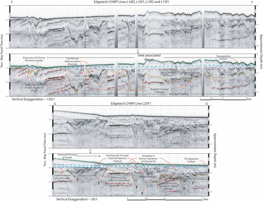
Figure 13. CHIRP sub-bottom profiles with interpretations from offshore Murrells Inlet. The two profiles provide subsurface imagery in shore parallel (Top, F - F') and shore perpendicular (Bottom, G - G') transects (located in figures 7 and 15). Both profiles illustrate the incised valley feature and overlying shoal complex associated with Murrells Inlet. Channels comprising the incised valley demonstrate the variability in cross sectional morphology and complex fill geometries that are observed in type I channel features (F - F' and G - G'). Examples of the geologically younger type II channel features are also illustrated (G - G'). Vertical scales for sub-bottom profiles are provided in both milliseconds (Two-Way Travel Time) and approximate depth in meters (assuming a seismic velocity of 1500 m/s).
|
Can't see the printable PDF version? Get the free Adobe Acrobat® Reader. |