Link to USGS home page Link to USGS home page
Coastal and Marine Geology Program
Coastal & Marine Geology Program > South Carolina Coastal Erosion Study > Open File Report 2004-1013

Maps Showing the Stratigraphic Framework of South Carolina's Long Bay from Little River to Winyah Bay

USGS Open File Report 2004-1013

by: Wayne E. Baldwin, Robert A. Morton, Jane F. Denny, Shawn V. Dadisman, William C. Schwab, Paul T. Gayes, and Neal W. Driscoll

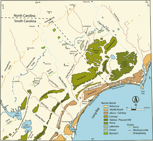
Figure 4. Geomorphological map of southeastern North Carolina and northeastern South Carolina (modified from DuBar and others, 1974). Pleistocene and Holocene barrier systems are shown. The sections of these terraces dissected by Piedmont (blue color) and Coastal Plain (brown color) rivers on their way to the coast are also illustrated.
Printable version of Figure 4.Printable Version of Fig. 4 (301 KB PDF)
Can't see the printable PDF version? Get the free Adobe Acrobat® Reader.
Geomorphological map of southeastern North Carolina and northeastern South Carolina.

Coastal & Marine Geology Program > South Carolina Coastal Erosion Study > Open File Report 2004-1013


[an error occurred while processing this directive]