Maps Showing the Stratigraphic Framework of South Carolina's Long Bay from Little River to Winyah Bay
USGS Open File Report 2004-1013
by: Wayne E. Baldwin, Robert A. Morton, Jane F. Denny, Shawn V. Dadisman, William C. Schwab, Paul T. Gayes, and Neal W. Driscoll
return to Mapping Results: Bathymetry and Sidescan-Sonar
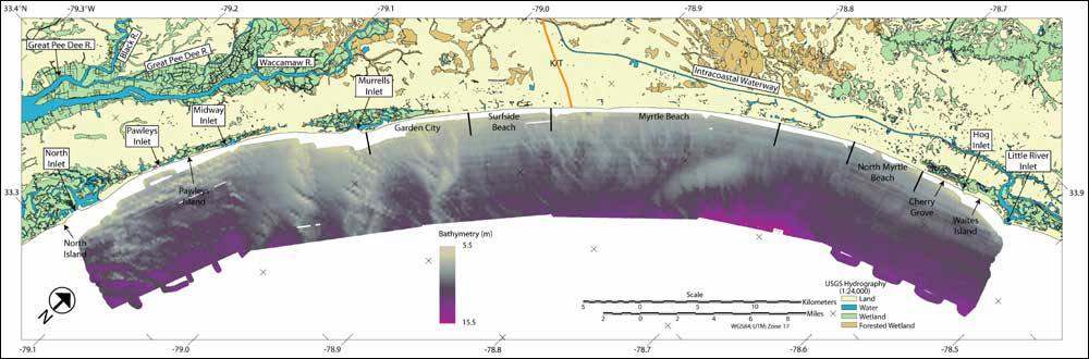
Figure 6. Submetrix Interferometric Sonar Bathymetry (234 kHz) coverage of the study area. Inter-line interpolation was required to generate a continuous bathymetric surface from ~ 70 - 100 m swath widths.
return to Mapping Results: Bathymetry and Sidescan-Sonar

[an error occurred while processing this directive]
