Figures 3-10 Click on each figure for a larger image.
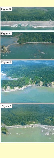
Figure 3: Shi Shi Beach in the north end of the park is classified as very high vulnerability. Washington Dept. of Ecology Photo.
Figure 4: Area north of Rialto Beach where geomorphology transitions from moderate to low vulnerability. Washington Dept. of Ecology Photo.
Figure 5: Hoh Head north of Hoh Indian Reservation is a rocky cliff at very low vulnerability. Washington Dept. of Ecology Photo.
Figure 6: Ruby Beach near Kalaloch is a gravel beach and considered high vulnerability. Washington Dept. of Ecology Photo.
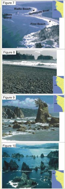
Figure 7: Shore parallel oblique view showing the diverse geomorphology, including river mouths, pocket beaches, and rocky headlands. NPS photo.
Figure 8: Rialto Beach near the Quileute Reservation is a cobble beach (high vulnerability). NPS photo.
Figure 9: Hole in the Wall north of Rialto Beach (low vulnerability). NPS photo.
Figure 10: Point of Arches (very low vulnerability). NPS photo.
|