Surficial Geology and Analysis of post-impoundment sediment of Lake Mohave
Open-File Report 2004-1256
|
Title Page / Introduction / Methods / Results / Discussion / Conclusion / Acknowledgments / References |
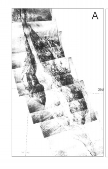
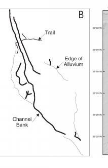
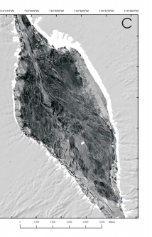
Figure 13. (A) Image of aerial photographic mosaic (not georeferenced) collected for the US Bureau of Reclamation in 1939 showing the morphology of the main basin of Lake Mohave before impoundment. (B) Interpretation of major geomorphic features observed on the aerial photography (A) and the sidescan sonar mosaic (C). The Aerial photograph mosaic and line drawing are not to scale and are likely distorted in comparison to the sidescan sonar mosaic.
Click for larger image (PDF version, 1.6 MB).
 |  |  |
![]() To view files in PDF format, download free copy of Adobe Reader.
To view files in PDF format, download free copy of Adobe Reader.
