Surficial Geology and Analysis of post-impoundment sediment of Lake Mohave
Open-File Report 2004-1256
|
Title Page / Introduction / Methods / Results / Discussion / Conclusion / Acknowledgments / References |
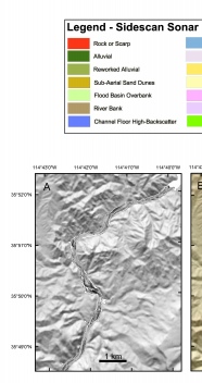
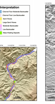
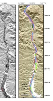
Figure 3. Sidescan sonar mosaics (A and C) and interpretations (B and D) of the surficial geology of the northern part of Lake Mohave. Location of Chirp profile (fig. 12b) is shown with a red line on the sidescan mosaic map in fig. 3c.
Click for larger image (PDF version, 4.5 MB).
 |
 |
 |
![]() To view files in PDF format, download free copy of Adobe Reader.
To view files in PDF format, download free copy of Adobe Reader.
