
![]()
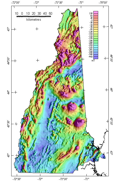
New Hampshire Magnetic Map
![]()
Composite magnetic map at flight altitude of 305 m, grid interval=500 m. Simulated illumination from the east. Click on map to view larger image (589 KB).
To view another state, click the State Magnetic Maps link below.
Top || Page 1 || Compilation || Processing || Index Maps || State Magnetic Maps || Gravity Map || Download data || References ||
USGS Links - || USGS - Eastern Minerals Team || USGS - Geology Discipline || USGS - Home Page ||