Open-File Report 2005-1048
OFR 2005-1048 Home / Introduction / Geologic Setting / GIS Data Catalog / Bottom Photographs
U.S. Geological Survey Open-File Report 2005-1048
Geological Interpretation of Bathymetric and Backscatter Imagery of the Sea Floor Off Eastern Cape Cod, Massachusetts
|
|
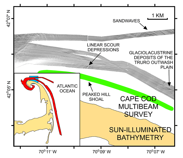
Figure 14
Sun-illuminated multibeam bathymetry from off northeastern Cape Cod. Image also shows locations of a field of sandwaves, linear scour depressions adjacent to Peaked Hill Shoal, and outcrops of fine-grained glaciolacustrine sediment. Inset shows map location (blue polygon) within survey area (red polygon). |
|
|
|
|

![]() U.S. Department of the Interior |
U.S. Geological Survey
U.S. Department of the Interior |
U.S. Geological Survey
URL: http://pubsdata.usgs.gov/pubs/of/2005/1048/htmldocs/figures/f14_peakedhillshoal.htm
Page Contact Information: GS Pubs Web Contact
Page Last Modified: Tuesday, 03-Sep-2024 14:31:01 EDT