Open-File Report 2005-1048
OFR 2005-1048 Home / Introduction / Geologic Setting / GIS Data Catalog / Bottom Photographs
U.S. Geological Survey Open-File Report 2005-1048
Geological Interpretation of Bathymetric and Backscatter Imagery of the Sea Floor Off Eastern Cape Cod, Massachusetts
|
|
Figure 17
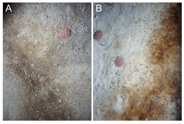
Bottom photographs showing sandy areas of the sea floor off Truro and Wellfleet. A) station CC62; B) station CC118. Note that gravel and brownish organic debris collect in the ripple troughs and that sand dollars congregate on the ripple crests. Sand dollars are approximately 7 cm in diameter. |
|
|
|
|

![]() U.S. Department of the Interior |
U.S. Geological Survey
U.S. Department of the Interior |
U.S. Geological Survey
URL: http://pubsdata.usgs.gov/pubs/of/2005/1048/htmldocs/figures/f17_ripplephotos.htm
Page Contact Information: GS Pubs Web Contact
Page Last Modified: Tuesday, 03-Sep-2024 14:34:21 EDT