Open-File Report 2005-1048
OFR 2005-1048 Home / Introduction / Geologic Setting / GIS Data Catalog / Bottom Photographs
U.S. Geological Survey Open-File Report 2005-1048
Geological Interpretation of Bathymetric and Backscatter Imagery of the Sea Floor Off Eastern Cape Cod, Massachusetts
|
|
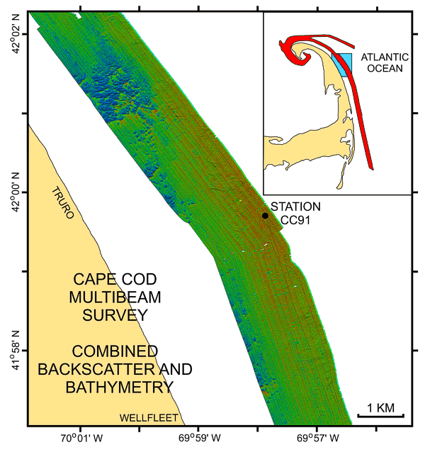
Figure 18
Pseudo-colored map of the sea floor off Truro showing combined bathymetry and backscatter intensity. Map shows a sand wave field, the general offshore trend toward higher backscatter and coarser sediments with this part of the study area, the gravelly area which probably consists of winnowed topset beds of the delta that built the Wellfleet outwash plain, and the location of station CC91. Inset shows map location (blue polygon) within survey area (red polygon). |
|
|
|
|

![]() U.S. Department of the Interior |
U.S. Geological Survey
U.S. Department of the Interior |
U.S. Geological Survey
URL: http://pubsdata.usgs.gov/pubs/of/2005/1048/htmldocs/figures/f18_ccpseudog.htm
Page Contact Information: GS Pubs Web Contact
Page Last Modified: Tuesday, 03-Sep-2024 14:35:03 EDT