Open-File Report 2005-1048
OFR 2005-1048 Home / Introduction / Geologic Setting / GIS Data Catalog / Bottom Photographs
U.S. Geological Survey Open-File Report 2005-1048
Geological Interpretation of Bathymetric and Backscatter Imagery of the Sea Floor Off Eastern Cape Cod, Massachusetts
|
|
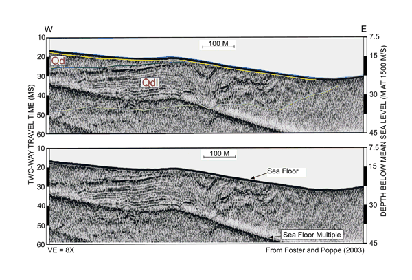
Figure 21
East-west seismic line from Foster and Poppe (2003). Seismic line shows the fine-grained glaciolacustrine deposits characterized by closely spaced internal reflectors within undifferentiated glacial drift, that this unit dips landward, and that it is truncated to the east by the Holocene transgression. See
Figure 20 for location of seismic line. |
|
|
|
|

![]() U.S. Department of the Interior |
U.S. Geological Survey
U.S. Department of the Interior |
U.S. Geological Survey
URL: http://pubsdata.usgs.gov/pubs/of/2005/1048/htmldocs/figures/f21_ccepewtsect.htm
Page Contact Information: GS Pubs Web Contact
Page Last Modified: Tuesday, 03-Sep-2024 14:37:20 EDT