Skip USGS links group
U.S. Geological Survey - science for a changing world
CZM logo with link to CZM home page
End of USGS links group

Open-File Report 2005-1048

OFR 2005-1048 Home / Introduction / Geologic Setting / GIS Data Catalog / Bottom Photographs

Skip title; go to table of contents Skip title; go to table of contents

U.S. Geological Survey Open-File Report 2005-1048

Geological Interpretation of Bathymetric and Backscatter Imagery of the Sea Floor Off Eastern Cape Cod, Massachusetts
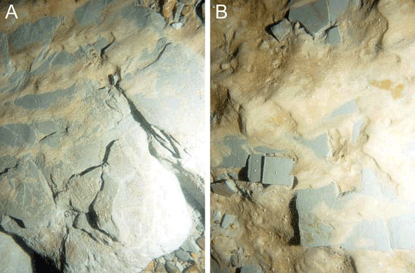

Figure 24

Figure 24: Bottom photographs from the Eastham outwash plain exposed at station CC183.

Bottom photographs showing distal fine-grained glaciolacustrine bottomset deposits from the Eastham outwash plain exposed at station CC183. Note ledge in A and rip-up clasts in B. Long dimension of the sea-floor area shown is approximately 1 m.


Skip footer Table of Contents; Go to Footer OFR 2005-1048 Home / Introduction / Geologic Setting / GIS Data Catalog / Bottom Photographs

Accessibility FOIA Privacy Policies and Notices

Take Pride in America logo USA.gov logo U.S. Department of the Interior | U.S. Geological Survey
URL: http://pubsdata.usgs.gov/pubs/of/2005/1048/htmldocs/figures/f24_epbotphotos.htm
Page Contact Information: GS Pubs Web Contact
Page Last Modified: Tuesday, 03-Sep-2024 14:44:17 EDT