Open-File Report 2005-1048
OFR 2005-1048 Home / Introduction / Geologic Setting / GIS Data Catalog / Bottom Photographs
U.S. Geological Survey Open-File Report 2005-1048
Geological Interpretation of Bathymetric and Backscatter Imagery of the Sea Floor Off Eastern Cape Cod, Massachusetts
|
|
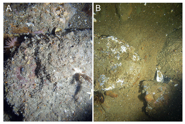
Figure 28
Bottom photographs showing winnowed more ice-proximal deltaic deposits of the Eastham outwash plain. A) Boulders with sessile fauna that includes an anemone at station
CC54. B) Gravel and coarse sand between boulders at station
CC53. Note lobster partly obscured by a boulder at lower left. Long dimension of the sea-floor area shown is approximately 1.6 m. See
Figure 27 for station locations. |
|
|
|
|

![]() U.S. Department of the Interior |
U.S. Geological Survey
U.S. Department of the Interior |
U.S. Geological Survey
URL: http://pubsdata.usgs.gov/pubs/of/2005/1048/htmldocs/figures/f28_rocky_gravelly2.htm
Page Contact Information: GS Pubs Web Contact
Page Last Modified: Tuesday, 03-Sep-2024 14:47:30 EDT