 |
|
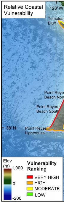
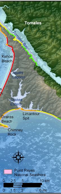
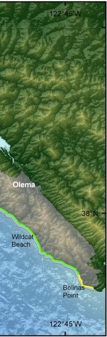
Figure 11. Relative Coastal Vulnerability for Point Reyes National Seashore. The colored shoreline represents the relative coastal vulnerability index (CVI) determined from the six variables. The very high vulnerability shoreline is located along sandy beaches where significant wave heights are highest and regional coastal slope vulnerability is low. The lower vulnerability shoreline is located along rock cliffs where wave heights are lower and coastal slope is steep. |
||
 |
 |
 |
