  |
Coastal Change-Potential Assessment of Sleeping Bear Dunes, Indiana Dunes, and Apostle Islands National Lakeshores to Lake-Level Changes
|
 |
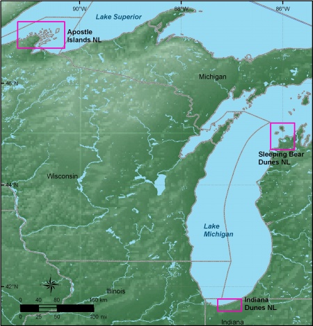
| Location map of Apostle Islands, Indiana Dunes, and Sleeping Bear Dunes National Lakeshores. Click on figure for larger image. |
By
Elizabeth A. Pendleton¹, E. Robert Thieler¹, and
S. Jeffress Williams¹
¹ USGS, Woods Hole Science Center, Woods Hole, Massachusetts 02543
U.S.
Geological Survey
Open-File Report 2005-1249
2007
|
For
Additional Information:
See the National Park Unit Coastal Vulnerability study at http://woodshole.er.usgs.gov/project-pages/nps-cvi/,
the National Coastal Vulnerability study at http://woodshole.er.usgs.gov/project-pages/cvi/,
or view the USGS online fact sheet for this project in PDF format at
http://pubs.usgs.gov/fs/fs095-02/.
Great Lakes National Lakeshores Web pages are at http://www.nps.gov/slbe/, http://www.nps.gov/apis, http://www.nps.gov/indu.
Contact:
http://woodshole.er.usgs.gov/project-pages/nps-cvi/
Telephone: 508-548-8700
Rebecca Beavers
National Park Service
Natural Resource Program Center
Geologic Resources Division
P.O. Box 25287
Denver, CO 80225-0287
Rebecca_Beavers@nps.gov
Telephone: 303-987-6945
 To view files in PDF format, download free copy of Adobe Reader.
Any use of trade names is for descriptive purposes only and does not imply endorsement by the U.S. Government.
|
|

