Title Page /
Abstract /
Report /
Figures /
References /
Acknowledgements /
Disclaimer
|
||
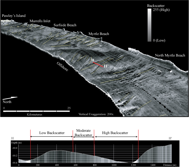
Figure 11. Top: Perspective view of sidescan-sonar imagery draped over bathymetry looking towards the southwest. Yellow lines indicate the crests of low-relief ridges. Vertical exaggeration is 200 x. Bottom: Shore-parallel bathymetric profile across a characteristic low-relief ridge showing variation in backscatter in relation to ridge morphology. High-backscatter covers the trough and NE side of the ridge, and moderate to low backscatter covers the crest and SW side. Depth is in meters. Distance is in kilometers. Note asymmetry of ridge with steeper slope facing to the southwest. | ||

![]() U.S. Department of the Interior |
U.S. Geological Survey
U.S. Department of the Interior |
U.S. Geological Survey
URL: http://pubsdata.usgs.gov/pubs/of/2005/1345/html/imagepages/fig11.html
Page Contact Information: Publishing Services
Page Last Modified: Saturday, 12-Jan-2013 22:12:19 EST