Title Page /
Abstract /
Report /
Figures /
References /
Acknowledgements /
Disclaimer
|
||
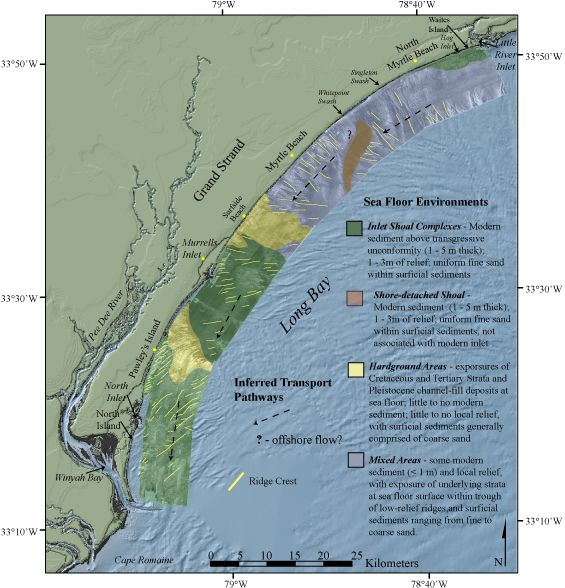
Figure 19. Map showing the four primary sea floor environments within Long Bay: inlet shoal complexes, shore-detached shoals, hardground and transition areas, and inferred sediment transport pathways based on seabed morphology and surficial textural distribution. | ||

![]() U.S. Department of the Interior |
U.S. Geological Survey
U.S. Department of the Interior |
U.S. Geological Survey
URL: http://pubsdata.usgs.gov/pubs/of/2005/1345/html/imagepages/fig19.html
Page Contact Information: Publishing Services
Page Last Modified: Saturday, 12-Jan-2013 22:12:26 EST