Title Page /
Abstract /
Report /
Figures /
References /
Acknowledgements /
Disclaimer
 |
||
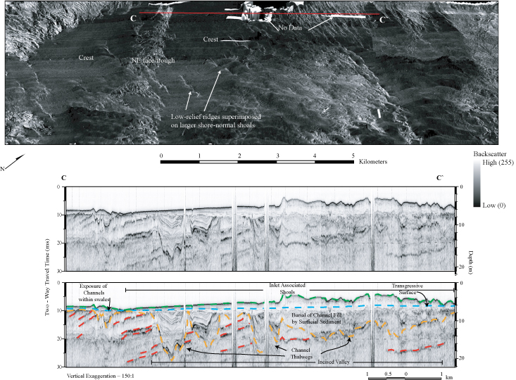
Figure 7. Sidescan-sonar imagery and chirp seismic-reflection profile across the inlet shoal complex offshore of Murrells Inlet. See figure 4 for figure location. Top: Perspective view of sidescan-sonar imagery draped over bathymetry, showing shore-oblique, low-relief ridges and the crest of the larger shore-normal shoals. Bottom: Chirp seismic-reflection profile shows the shoal complex overlying the transgressive surface, which truncates Pleistocene channels (yellow) and Cretaceous strata (red). Depth is approximate and assumes a seismic velocity of 1500 m/sec. Figure modified from Baldwin and others (2004, their figure 13). | ||

![]() U.S. Department of the Interior |
U.S. Geological Survey
U.S. Department of the Interior |
U.S. Geological Survey
URL: http://pubsdata.usgs.gov/pubs/of/2005/1345/html/imagepages/fig7.html
Page Contact Information: Publishing Services
Page Last Modified: Saturday, 12-Jan-2013 22:12:32 EST