Open-File Report 2005-1346
Title Page /
Table of Contents /
Introduction /
Geographic Information System /
References /
Acknowledgements
 |
||
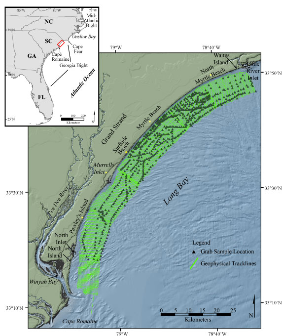
Figure 1. Map showing the location of the survey area offshore of South Carolina between Little River Inlet to the north and Winyah Bay to the south. Geophysical tracklines and sample locations are displayed. | ||

![]() U.S. Department of the Interior |
U.S. Geological Survey
U.S. Department of the Interior |
U.S. Geological Survey
URL: http://pubsdata.usgs.gov/pubs/of/2005/1346/html/imagepages/fig1.html
Page Contact Information: GS Pubs Web Contact
Page Last Modified: Tuesday, 02-Jul-2024 16:06:40 EDT
