Open-File Report 2005-1413
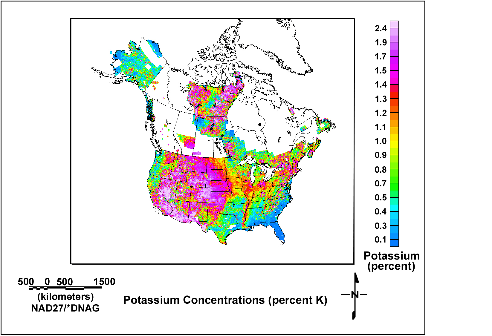
The figure below shows the concentrations of potassium. Click here to view a full-resolution version of the map.
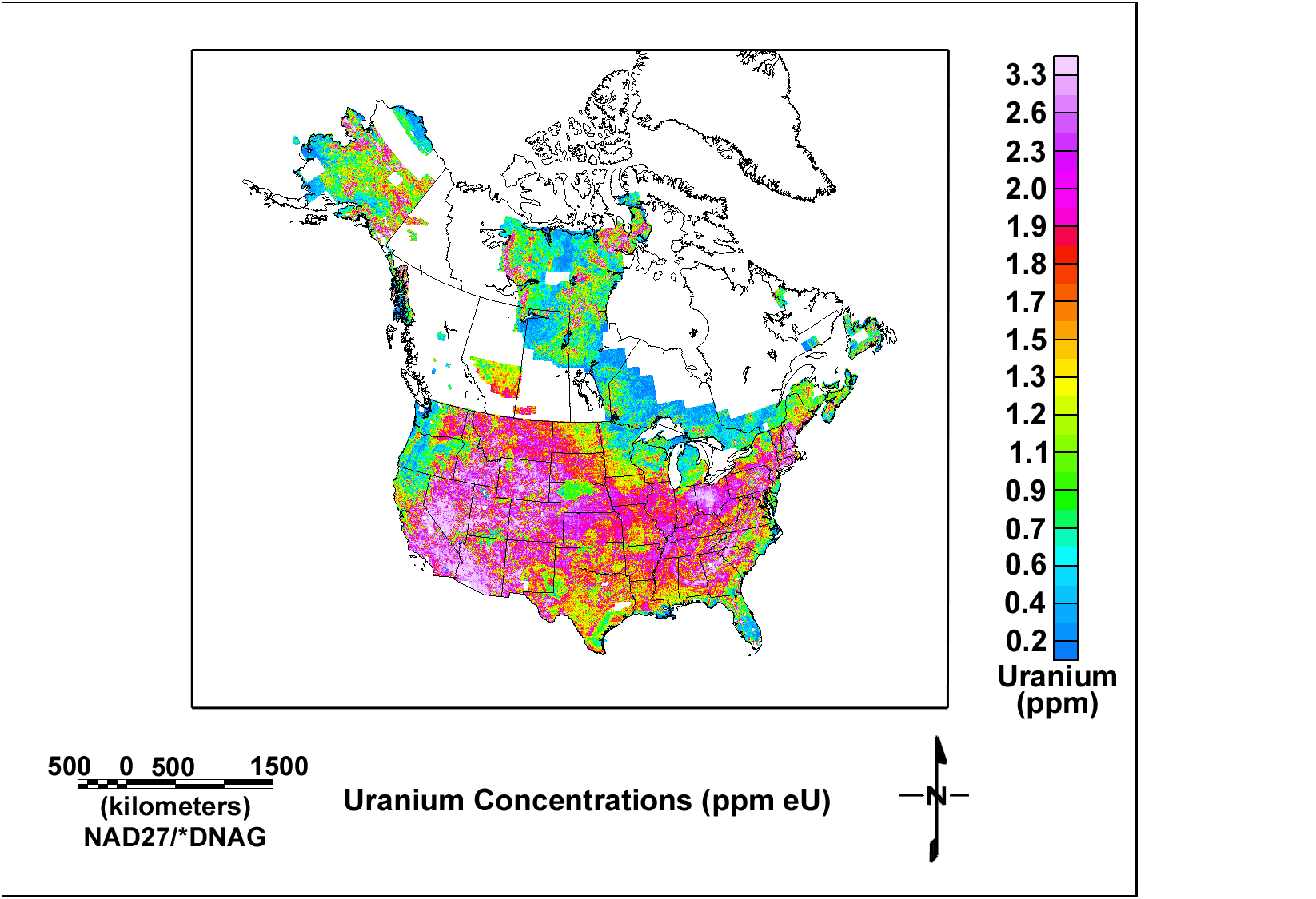
The figure below shows the concentrations of uranium. Click here to view a full-resolution version of the map.
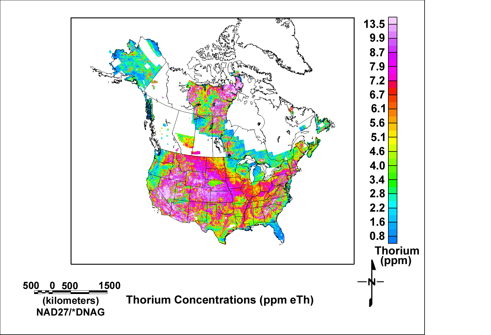
The figure below shows the concentrations of thorium. Click here to view a full-resolution version of the map.
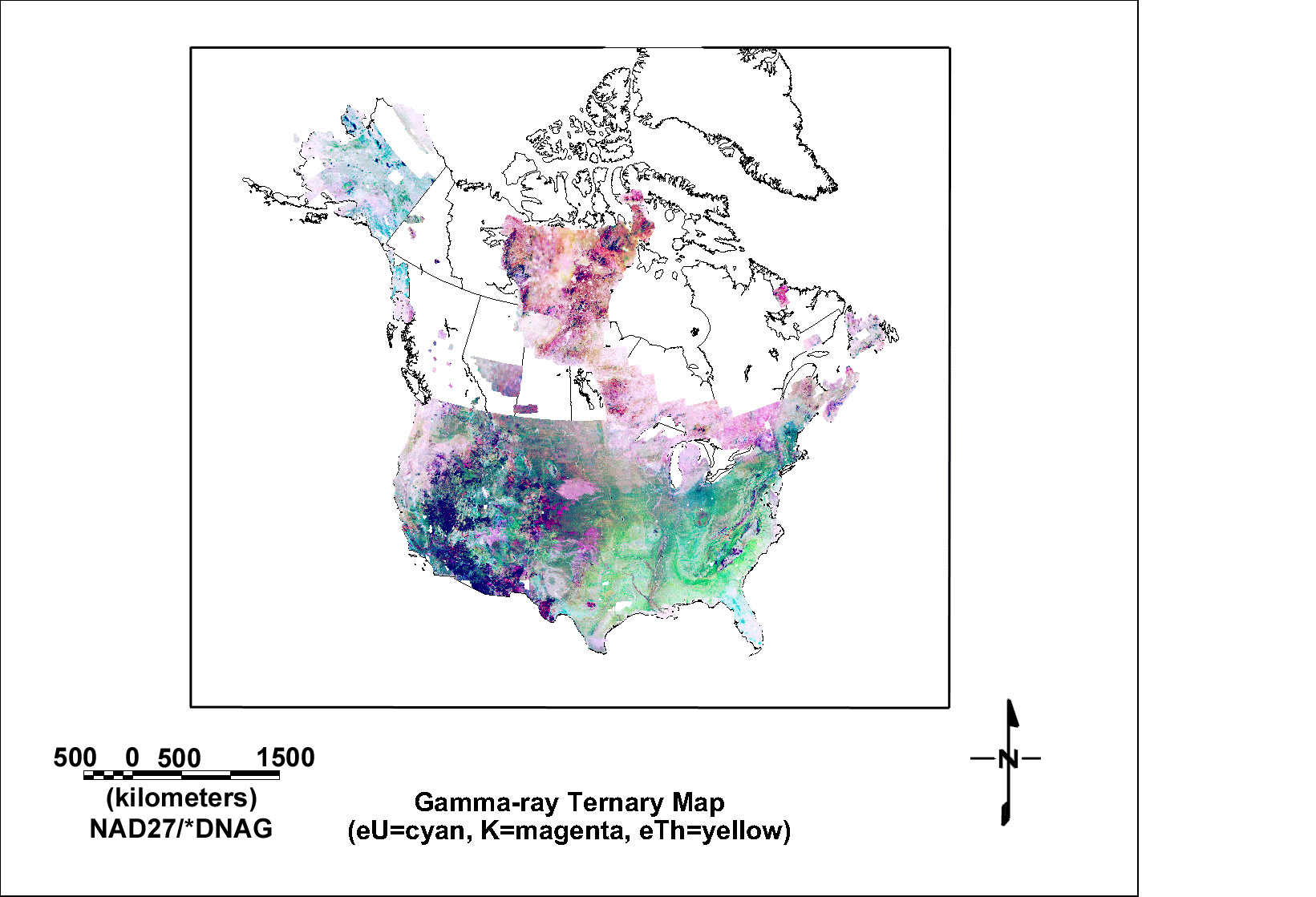
The map below shows a ternary map of the gamma-ray data where the uranium data are plotted as shades of cyan, potassium as shades of magenta, and thorium as shades of yellow. Darker or more saturated colors correspond to higher radioactivity and lighter or less saturated colors reflect lower radioactivity. Click here to view a full-resolution version of the map.
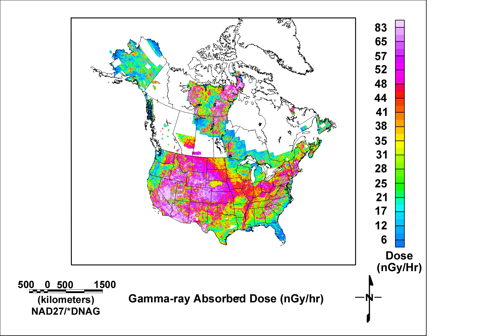
The map below shows the calculated gamma-ray absorbed dose from terrestrial sources. Click here to view a full-resolution version of the map. The absorbed dose calculated here is based upon an equation published by Grasty and others (1984).
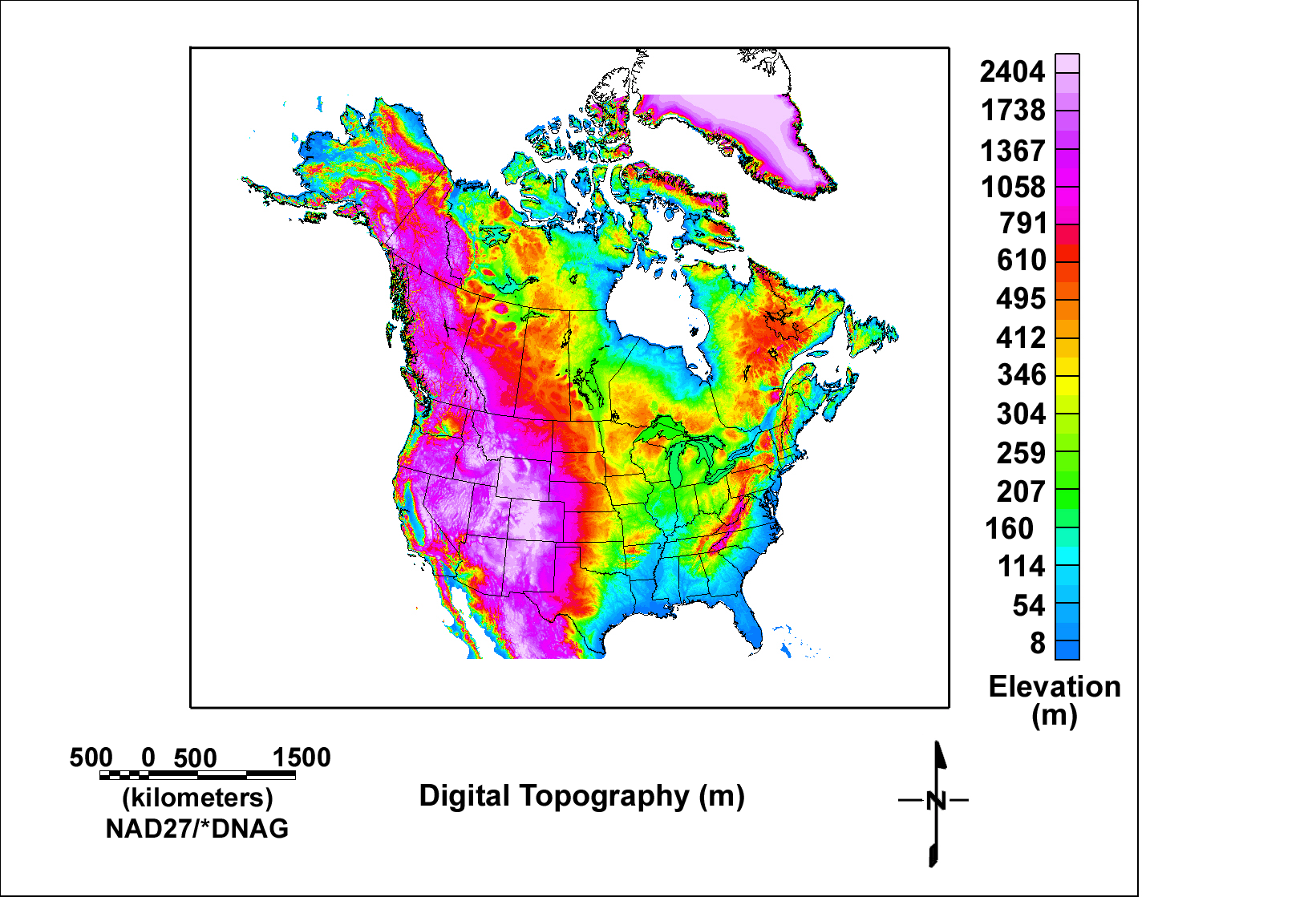
The map below shows a map of the digital elevation data. The elevation data were taken from the world database of 1 km digital elevation and were regridded using a 2 km grid cell. Click here to view a full-resolution version of the map.
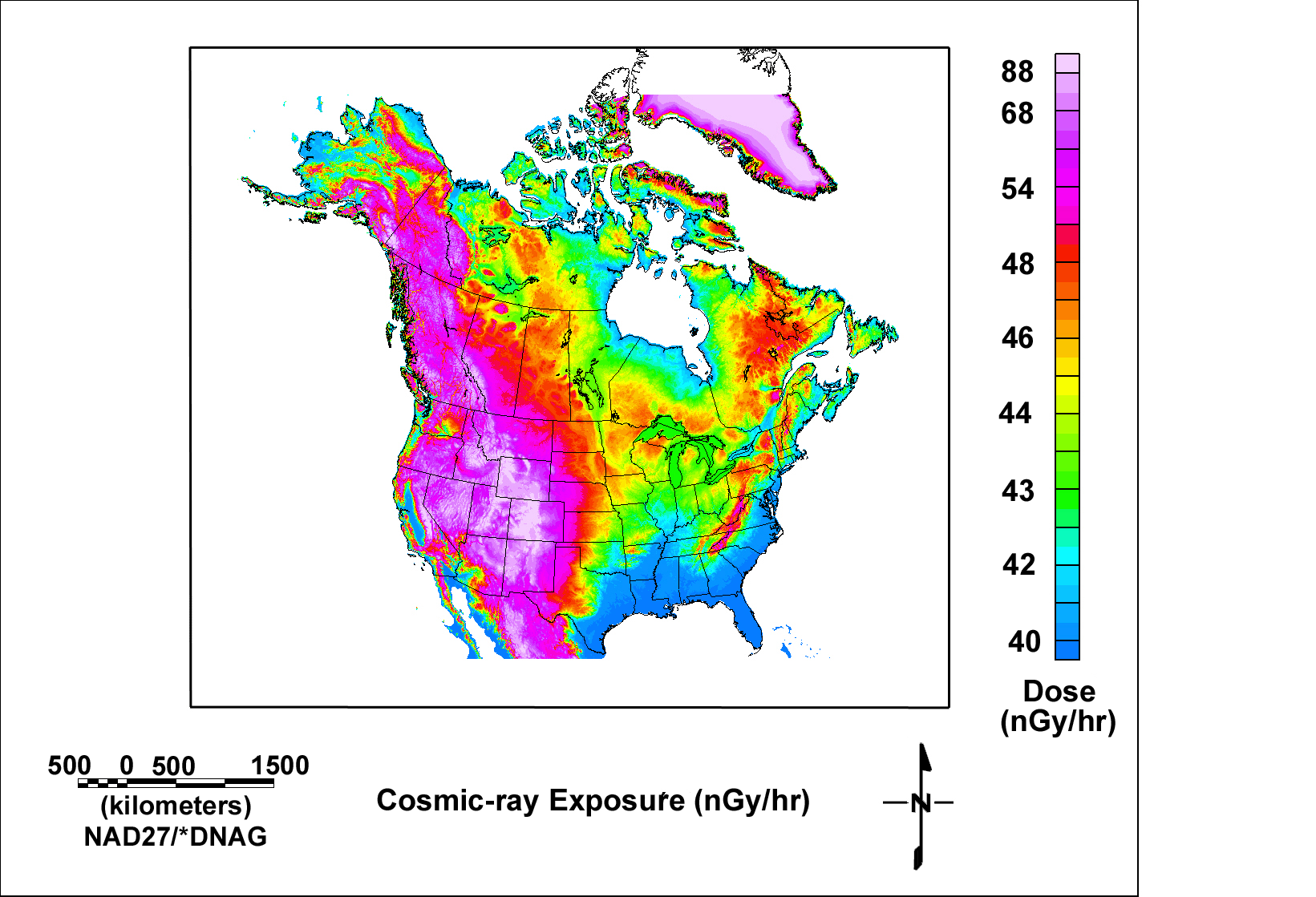
The map below shows the cosmic-ray exposure calculated from the topography. Click here to view a full-resolution version of the map. The exposure was calculated using equations published by Boltneva, Nazarov, and Fridman (1974).
Home | Data Files | Data Processing | Flightline Databases | Maps | References | Glossary

![]() U.S. Department of the Interior |
U.S. Geological Survey
U.S. Department of the Interior |
U.S. Geological Survey
URL: http://pubsdata.usgs.gov/pubs/of/2005/1413/maps.htm
Page Contact Information: USGS Publications Team
Page Last Modified: Saturday, 12-Jan-2013 21:49:04 EST
