|
|
|
|
|
| Report Home | Maps | Overview | Mapping Methods | Coastal Classifications | Geologic Setting | Coastal Processes | Coastal Vulnerability | Classification Summary | References | |||||||||||||||||||||||||||||||
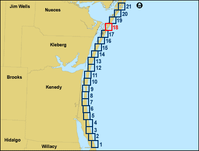
| Introduction || City: South of Potrero Lopeno | Potrero Lopeno | Potrero Cortado | Yarborough Pass | South Bird Island | Pita Island/Crane Islands | Crane Islands | Port Aransas | ||||||||||||||||||||||||||||||||||||||||
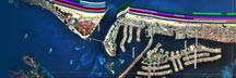
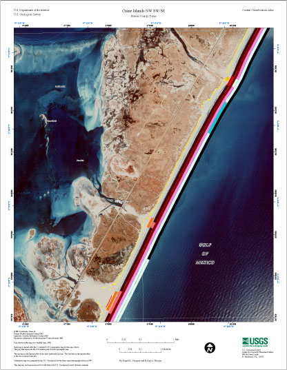
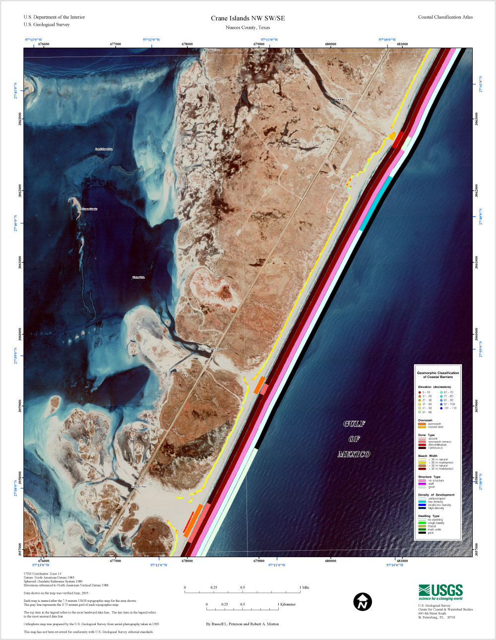
| Maps: Crane Islands SW NW | Crane Islands NW SW/SE | Crane Islands NW NE/Crane Islands NW OE E NW | ||||||||||||||||||||||||||||||||||||||||
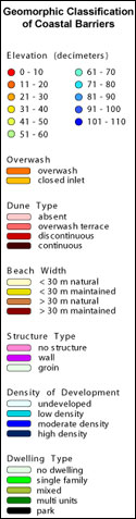
Central Texas Coastal Classification MapCoastal Classification Map for Crane Islands NW SW/SE. Map showing the coastal classifications along the Central Texas shoreline. The top item in the legend refers to the most landward data line. The last item in the legend refers to the most seaward data line. Click on the links below to download and view larger versions of the map. At the bottom of the page is a clickable index map that will take you to the other maps.
|
| AccessibilityFOIAPrivacyPolicies and Notices | |
 |
|