OF 06-1204: Southeastern Afghanistan Aeromagnetics
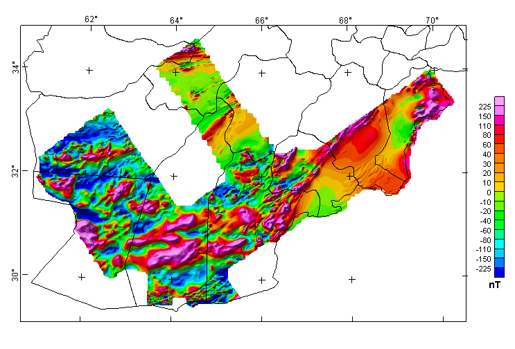
Aeromagnetic data were digitized from maps created from aeromagnetic surveys flown in southeastern and southern Afghanistan in 1966 by PRAKLA, Gesellschaft für praktische Lagerstättenforschung GmbH, Hanover, Germany, on behalf of the Bundesanstalt für Bodenforschung, Hanover, Germany. The digitization was done along contour lines, followed by interpolation of the data along the original survey flight-lines. Survey and map specifications can be found in two project reports, "prakla_report_1967.pdf" and "bgr_report_1968.pdf", made available in this open-file report. The purpose of the aeromagnetic surveys was for a more detailed investigation of the sedimentary basins in the southeastern and southern part of Afghanistan, as well as the localization of possibly existing magnetic deposits. DATA PRODUCTS All grids are presented in Geosoft binary grid format, with two files describing each of the grids (suffixes .grd and .gi). All databases are presented in Geosoft database format, with two files describing each of the databases (suffixes .gdb and .gd~). Either of these formats can be converted to other formats using the free conversion software offered by this company at http://www.geosoft.com/.
PROJECTION SPECIFICATIONS All databases, maps, grids, and xyz files in this report use the following projection specifications:
This web site makes available to users the data products mentioned above for this survey. To view this directory, click on the link below. To view the README file describing the aeromagnetic data product files, click on the README link following. README_GDR_datafiles PDF file describing data in above directory For more information about this report contact: Pat Hill |
Version 1.0 Posted August 2006
Refer to the README_GDR_datafiles PDF file for a description of data in the above "German_mag" directory.
|
| AccessibilityFOIAPrivacyPolicies and Notices | |
| |
|
