|
Metadata also available as - [Outline] - [Parseable text] - [XML]
Frequently-anticipated questions:
- Title:
- High-resolution chirp seismic-reflection data acquired from theCap de Creus shelf and canyon area, Gulf of Lions, Spain in 2004
- Abstract:
- This report consists of high-resolution chirp seismic reflection profiledata from the northern Gulf of Lions, Spain. These data were acquired in 2004 using the Research Vessel Oceanus (USGS Cruise ID: O-1-04-MS). Thedata are available in binary and JPEG image formats. Binary data arein Society of Exploration Geologists (SEG) SEG-Y format and may bedownloaded for further processing or display. Reference maps andJPEG images of the profiles may be viewed with your Web browser.
- Supplemental_Information:
- Chirp seismic reflection profiles are acquired by means of anacoustic source and a hydrophone array, both contained in a single unittowed in the water behind a survey vessel. The sound source emits ashort (30 ms) swept-frequency (500 to 7200 Hz)acoustic pulse,which propagates through the water and sediment columns. The acousticenergy is reflected at density boundaries (such as the seafloor orsediment layers beneath the seafloor), and detected by the hydrophonearray, and digitally recorded by the onboard PC-based acquisition system.As the vessel moves, this process is repeated multiple times per second,producing a two-dimensional image of the shallow geologic structurebeneath the ship track.Additional information about the USGS survey O-1-04-MS is available at<http://walrus.wr.usgs.gov/infobank/o/o104ms/html/o-1-04-ms.meta.html>.
- How should this data set be cited?
Grossman, Eric, Hart, Patrick E. , Field, Michael E. , and Triezenberg, Peter, 2006, High-resolution chirp seismic-reflection data acquired from the Cap de Creus shelf and canyon area, Gulf of Lions, Spain in 2004: U.S. Geological Survey Open-File Report 2006-1247, U.S. Geological Survey, Menlo Park, CA.Online Links: - What geographic area does the data set cover?
- West_Bounding_Coordinate: 3.1808
- East_Bounding_Coordinate: 3.4586
- North_Bounding_Coordinate: 42.4418
- South_Bounding_Coordinate: 42.1763
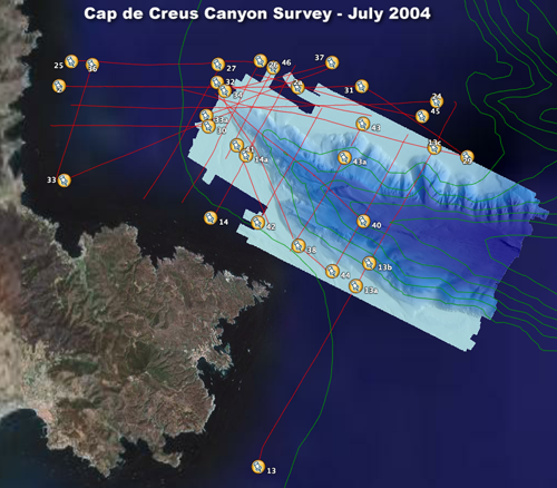
- What does it look like?
- <http://pubs.usgs.gov/of/2006/1247/images/gol_coverage_area.png> (PNG)
- Map of Gulf of Lions showing areas of 2004 USGS chirp seismic refleciton research cruise
- Does the data set describe conditions during a particular time period?
- Beginning_Date: 25-Sep-2003
- Ending_Date: 01-Oct-2003
- Currentness_Reference:
- Data assumed to be constant over time, but the imaged geology maychange due to geologic processes.
- What is the general form of this data set?
- Geospatial_Data_Presentation_Form: seismic reflection profile section
- How does the data set represent geographic features?
- How are geographic features stored in the data set?
- Indirect_Spatial_Reference:
- Horizontal X and Y locations for the seimic profiles location are providedin ASCII position files and are alos stored in the SEG-Y data trace headersin the standard header locations.
- What coordinate system is used to represent geographic features?
Horizontal positions are specified in geographic coordinates, that is, latitude and longitude.Latitudes are given to the nearest 0.00001.Longitudes are given to the nearest 0.00001.Latitude and longitude values are specified in decimal degrees. The horizontal datum used is WGS 84.
The ellipsoid used is WGS 84.
The semi-major axis of the ellipsoid used is 6378137 m.
The flattening of the ellipsoid used is 1/298.257.
- How does the data set describe geographic features?
- Entity_and_Attribute_Overview:
- Binary data file: Each profile isavailable as a binary file in Society of Exploration GeophysicistsSEG-Y format. A SEG-Y file consists of 1) a 3200-byte fileidentification record of EBCDIC encoded general information; 2) a400-byte binary record with information such as sample rate andrecord length specific to the data set; and 3) multiple records, oneseismic reflection trace per record. Each trace record is precededby a 240-byte "trace header" containing information such as tracenumber and acquisition day and time specific to each trace. Thetrace data are represented as a time series of unitless 16-bitinteger or 32-bit real numbers proportional to the pressure recordedat each hydrophone. The SEG-Y file is useful only if you have accessto specialized software designed to process and display seismicreflection data.
- Entity_and_Attribute_Detail_Citation:
- Barry, K.M., Cavers, D.A., andKneale, C.W., 1975, Recommended standards for digital tape formats:Geophysics, v. 40, n. 2, p. 344 - 352. Also available online at:<http://www.seg.org/publications/tech-stand/>
- Entity_and_Attribute_Overview:
- Graphic image file: Each profile isavailable as a JPEG image.
- Who are the originators of the data set? (may include formal authors, digital compilers, and editors)
- Eric Grossman
- Patrick E. Hart
- Michael E. Field
- Peter Triezenberg
- Who also contributed to the data set?
- To whom should users address questions about the data?
Eric Grossman U.S. Geological Survey Geologist 400 Natural Bridges Drive Santa Cruz, CA 95060-5792 USA 831-427-4725 (voice)
egrossman@usgs.gov
Marine seismic reflection data are used to image and mapsedimentary and structural features of the seafloor and subsurface.These data were acquired across the shelf and canyon area of the Gulfof Lions, Spain as part of a multinational effort to characterize thegeologic framework and sedimentary environment of the region.The specific objective of this seismic survey is to provide seismicreflection images of the depositional geometry of the upper 50 meters ofsubbottom stratigraphy in order to better understand the mechanisms ofsediment transport and deposition. These chirp seismic profiles providehigh-quality images with approximately 20 cm of verticalresolution and up to 80 m of subbottom penetration.
- From what previous works were the data drawn?
- How were the data generated, processed, and modified?
- Date: 2004 (process 1 of 2)
- Single-channel chirp seismic reflection data were acquired using anEdgetech 512i subbottom profiling system. This "fish " was towed aftof the research vessel at a depth of approximately 15 meters at aship speed of approximately 4 knots. A 30 ms swept-frequency(500 to 7200 Hz)"chirp" source signal was emitted 1 to 4 timesper second depending on water depth and the returning reflectionswere detected by hydrophones located along the bottom of the fish.The data were digitally recorded by an on-board PC-based Delph Seismicrecording system. Differential GPS position fixes were written intothe seismic data trace headers and are also available in an ASCIItext file.
- Date: 2004 (process 2 of 2)
- Open File preparation: The seismic profiles were converted fromDelph Seimic proprietary format to standard SEG-Y format and toCGM plot files using Paradigm Focus software. Then the CGM files wereconverted to 300 dots per inch JPEG image file using Larson CGM toImage software. The SEG-Y data files and the JPEG image files areavailable for download from this on-line report.
Person who carried out this activity:
Patrick E. Hart U.S. Geological Survey Geophysicist 345 Middlefield Road Mail Stop 999 Menlo Park, CA 94025-3561 USA 650-329-5160 (voice)
hart@usgs.gov
- What similar or related data should the user be aware of?
Alonso, B., Canals, M., Got, H., and Maldonado, A., 1991, Sea valleys and related depositional systems in the Gulf of Lions and Ebro continental margin: American Association of Petroleum Geologists Bulletin 75, p. 1195-1214, American Association of Petroleum Geologists, Tulsa, OK. Baztan, J., Berné, S.,, Olivet, J.-L, Rabineau, M., Aslanian, D., Gaudin, M., Réhault, J.P., and Canals, M., 2005, The axial incision: the key to understand canyon evolution (in the western Gulf of Lions): Marine and Petroleum Geology 22, n. 6-7, p. 805-826, Butterworth Scientific Ltd., Guildford, Surrey, England. Berné, S., Carré, D., Loubrieu, B., Mazé, J.-P., and Normand, A., 2001, Carte morphobathymétrique du Golfe du Lion à l échelle 1/100 000 éme: Ifremer, Brest, Brest, France. Berné, S., and Gorini, C., 2005, The Gulf of Lions: An overview of recent studies within the French Margins Programme: Marine and Petroleum Geology 22, n. 6-7, p. 691-693, Butterworth Scientific Ltd., Guildford, Surrey, England. Berné, S., Carré, B., Loubrieu, B., Mazé, J.P., Morvan, L., and Normand, A., 2004, Le Golfe du Lion. Carte morpho-bathymétrique: Ifremer, Brest, Brest, France. Berné, S., Loubrieu, B., and The Calmar scientific party, 1999, Canyons and recent sedimentary processes on the western Gulf of Lions margin: First results of the Calmar cruise. Comptes Rendus de l'Académie des Sciences de Paris 328: 471-477, l'Académie des Sciences de Paris, Paris. Berné, S., Loubrieu, B., and CALMAR, léquipe embarquée , 1997, Carte morpho-bathymetrie de la marge occidentale du Golfe du Lion à l échelle 1/250 000 éme: Ifremer, Brest, Brest, France. Correggiari, A., Trincardi, F., Langone, L., and Roveri, M., 2001, Styles of failure in Late Holocene highstand prodelta wedges on the Adriatic shelf: Journal of Sedimentary Geology 71, p. 218-236, SEPM (Society for Sedimentary Geology), Tulsa, OK. Grossman, E.E., Hart, P., and Field, M.E., 2005, Evidence of recent sediment storage and transport from shallow seismic stratigraphy on the Cap de Creus shelf, Spain: EuroSTRATAFORM - Promess Joint Meeting, Salamanca, Spain, October 24-27, 2005 October 24-27, 2005. - Other_Citation_Details:
- <http://www.soc.soton.ac.uk/CHD/EUROSTRATAFORM/salamanca2005/index.html>
Lofi, J., Rabineau, M., Gorini, C., Berne, S., Clauzon, G., De Clarens, P., Tadeu Dos Reis, A., Mountain, G.S., Ryan, W.B.F., Steckler, M.S., and Fouchet, C., 2003, Plio-Quaternary prograding clinoform wedges of the western Gulf of Lion continental margin (NW Mediterranean) after the Messinian Salinity Crisis: Marine Geology 198(3-4): 289-317, Elsevier Scientific Pub. Co, Amsterdam. Marsset, T., and Bellec, V., 2002, Late Pleistocene-Holocene deposits on the Rhone inner continental shelf (France): detailed mapping and correlation with previous continental and marine studies: Sedimentology 49, p. 255-276, Oxford, Boston, Blackwell Scientific Publishers. Rabineau, M., Berné, S., Le Drezen, E., Lericolais, G., and Rutunno, M., 1998, 3D architecture of lowstand and transgressive Quaternary sand bodies on the outer shelf of the Gulf of Lions, France: Marine Petroleum Geology 15, p. 439-452, Butterworth Scientific Ltd., Guildford, Surrey, England. Rabineau, M., Berné, S., Aslanian, D., Olivet, J.-L., Phillipe, J., Guillocheau, F., Bourillet, J.-F., Ledrezen, E., and Granjeon, D., 2005, Sedimentary sequences in the Gulf of Lions: a record of 100,000 years climatic cycles: Marine and Petroleum Geology 22, n. 607, p. 775-804, Butterworth Scientific Ltd., Guildford, Surrey, England. Schoolmeester, T., Grossman, E.E., García-García, A., Canals, M., Field, M., Levey, M., Fabres, J., and Orange, D., 2005, Shallow Sediment Structure revealed from High Resolution Surveys in the Upper Cap de Creus Canyon: EuroSTRATAFORM - Promess Joint Meeting, Salamanca, Spain, October 24-27, 2005 October 24-27, 2005. - Other_Citation_Details:
- <http://www.soc.soton.ac.uk/CHD/EUROSTRATAFORM/salamanca2005/index.html>
Torres, J., Savoye, B., and Cochonat, P., 1995, The effects of sea level changes on the Rhone slope sedimentation (northwestern Mediterranean) as indicated by seismic stratigraphy: Journal of Sedimentary Research 65, p. 368-38, SEPM (Society for Sedimentary Geology), Tulsa, OK.
- How well have the observations been checked?
The validity or accuracy of marine seismic reflection profiles ishighly qualitative, and depends on equipment and operating conditionvariables too numerous to quantify. There have been no efforts toassess the validity of the data. - How accurate are the geographic locations?
Positions were determined withdifferential Global Positioning System (GPS). Absolute positionaccuracy was approximately plus/minus 10 m. - How accurate are the heights or depths?
The vertical position was local sea level and there have been nocorrections to a datum or for tidal variations. - Where are the gaps in the data? What is missing?
These are sparse line coverages (2D).Therefore, data are inherently incomplete. Geologic details betweenlines must be inferred. The surveys were not designed to cover aparticular geographic area; the line spacings and azimuths were chosento assess the regional stratigraphy. - How consistent are the relationships among the observations, including topology?
These data have not been assessed for internal consistency.
Are there legal restrictions on access or use of the data?- Access_Constraints: None. These data are held in the public domain.
- Use_Constraints:
- The U.S. Geological Survey requests to be acknowledged as the originatorof the data in future products or derivative research.
- Who distributes the data set? (Distributor 1 of 1)
Eric Grossman U.S. Geological Survey Geologist USGS, 400 Natural Bridges Drive Santa Cruz, CA 95060-5792 USA 831-427-4725 (voice)
egrossman@usgs.gov
- Contact_Instructions:
- Data may be available off-line only by specialarrangement with the distributor above. Please use the on-linedownload option unless precluded by download times or accessdifficulties.
- What's the catalog number I need to order this data set?
U.S. Geological Suvey Open-File Report 2006-1247 - What legal disclaimers am I supposed to read?
This dataset was prepared by an agency of theUnited States Government. Neither the United States Government nor anyagency thereof nor any of their employees, make any warranty, expressedor implied, or assumes any legal liability or responsibility forinformation, apparatus, products, or processes disclosed in thisreport, nor represents that its use would not infringe privately ownedrights. Reference herein to any specific commercial product, process,or service by trade name, trademark, manufacturer, or otherwise doesnot constitute or imply its endorsement, recommendation, or favoringby the United States Government or any agency thereof.Although all data published in this report have been used by the USGS,no warranty, expressed or implied, is made by the USGS as to theaccuracy of the data and related materials. The act of distributionshall not constitute any such warranty, and no responsibility isassumed by the USGS in the use of this data. - How can I download or order the data?
- Availability in digital form:
- Cost to order the data: none
- What hardware or software do I need in order to use the data set?
Use of SEG-Y data requires specialized software,such as ProMax and Seisworks by Landmark Geophysical; FOCUS and SeisXby Paradigm Geophysical; SPW by Parallel Geoscience; or VISTA bySeismic Image Software.
- Dates:
- Last modified: 28-Jul-2006
- Metadata author:
Eric Grossman U.S. Geological Survey Geologist USGS, 400 Natural Bridges Drive Santa Cruz, CA 95060-5792 USA 831-427-4725 (voice)
egrossman@usgs.gov
- Metadata standard:
- Content Standard for Digital Geospatial Metadata (FGDC-STD-001-1998)
Accesibility | FOIA | Privacy | Policies and Notices
U.S. Department of the Interior U.S. Geological Survey Coastal & Marine Geology Program
URL: http://pubs.er.usgs.gov/usgspubs/ofr/ofr20061247
Contact Information: Eric Grossman
Last Modified: Jul 28 09:34 2006 (cd)
Generated by mp version 2.8.11 on Fri Jul 28 09:36:14 2006
|
|
