|
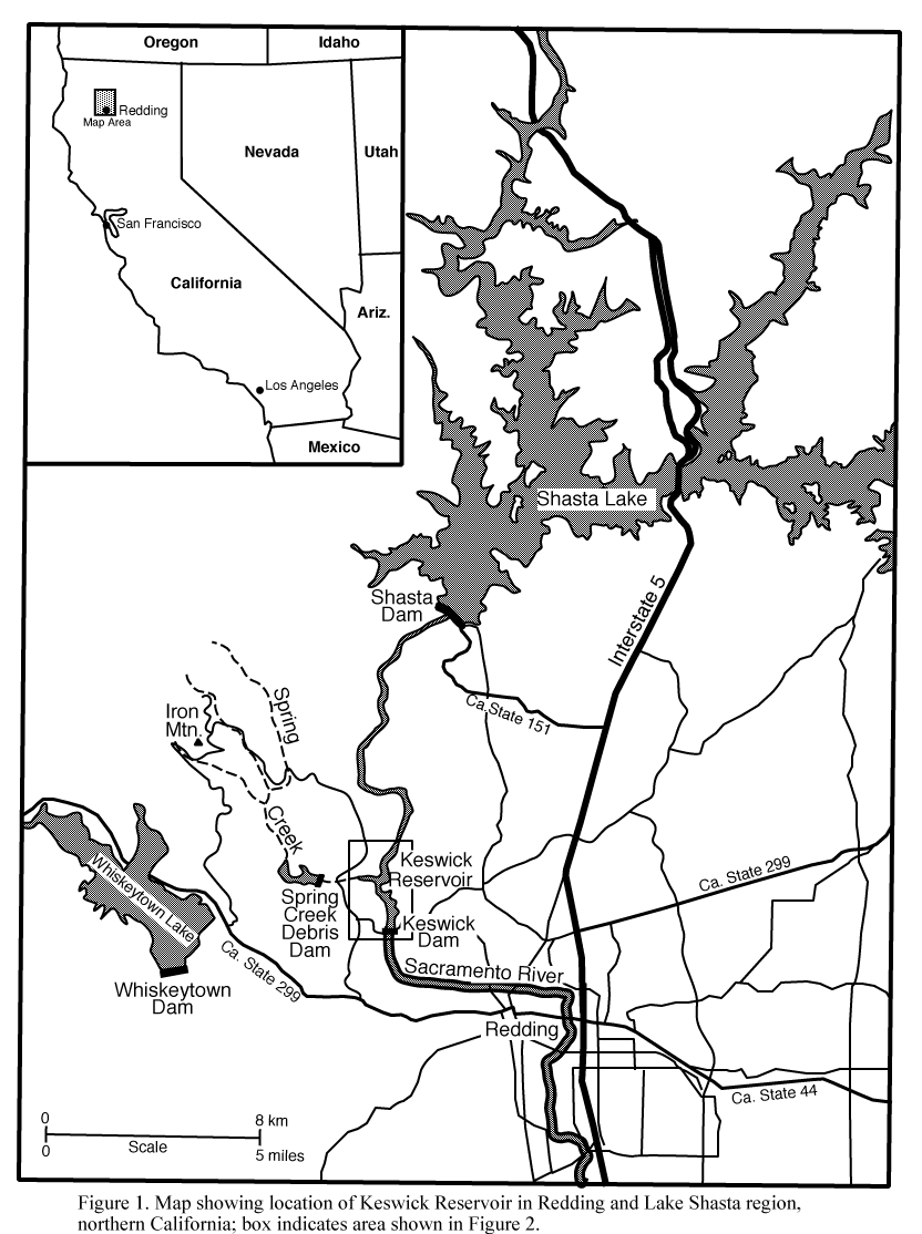
Figure 1. Map showing location of Keswick Reservoir in the Redding and Lake Shasta region, northern
California; box indicates area shown in Figure 2.
View full-size image (76 Kb)
|
|
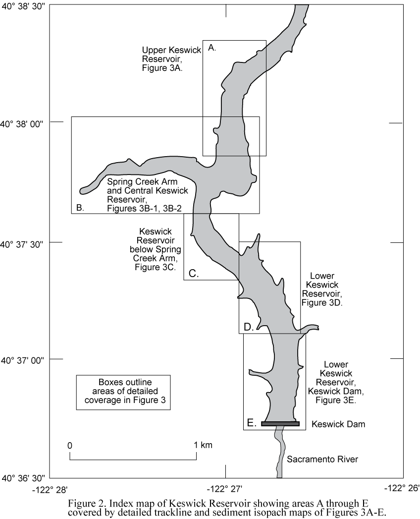
Figure 2. Index map of Keswick Reservoir showing areas A through E covered by detailed trackline
and sediment isopach maps of Figures 3A-E.
View full-size image (48 Kb)
|
|
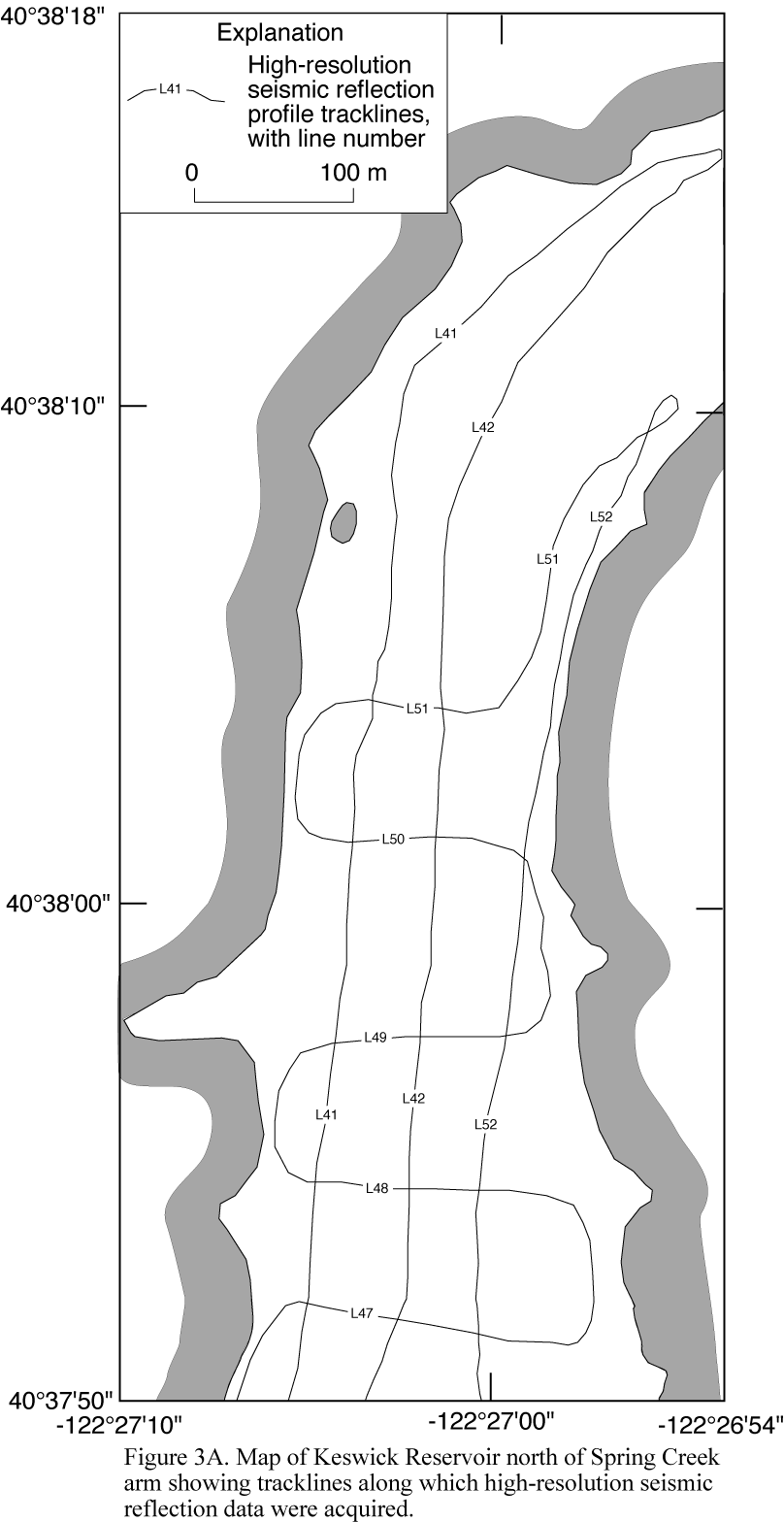
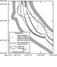
Figure 3A. Map of Keswick Reservoir north of Spring Creek Arm showing tracklines along which
high-resolution seismic-reflection data were acquired.
View full-size image (64 Kb)
|
|
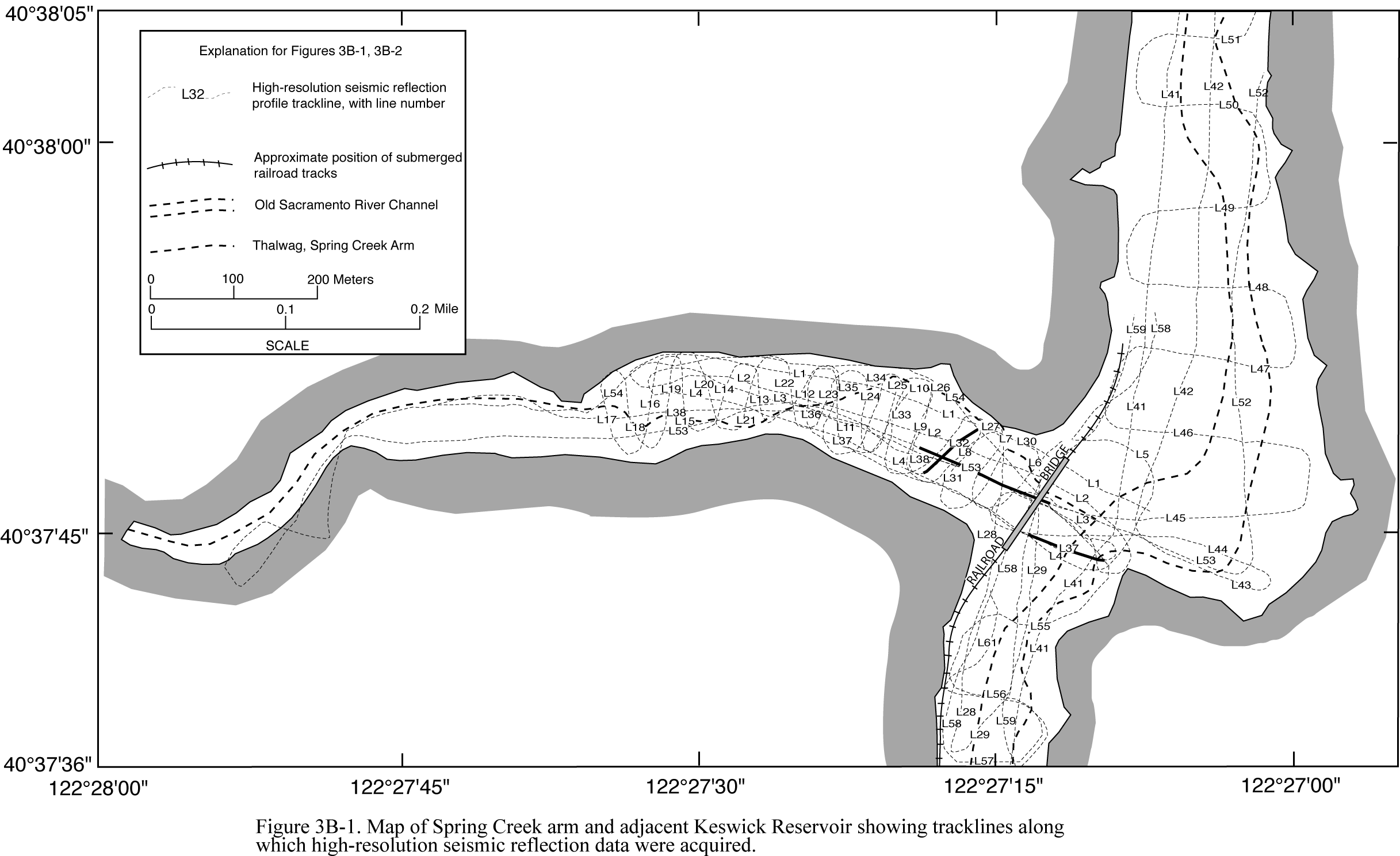
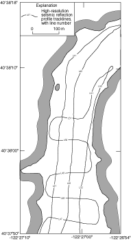
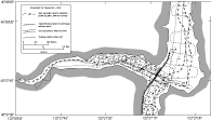
Figure 3B-1. Map of Spring Creek Arm and adjacent Keswick Reservoir showing tracklines along
which high-resolution seismic-reflection data were acquired.
View full-size image (156 Kb)
|
|
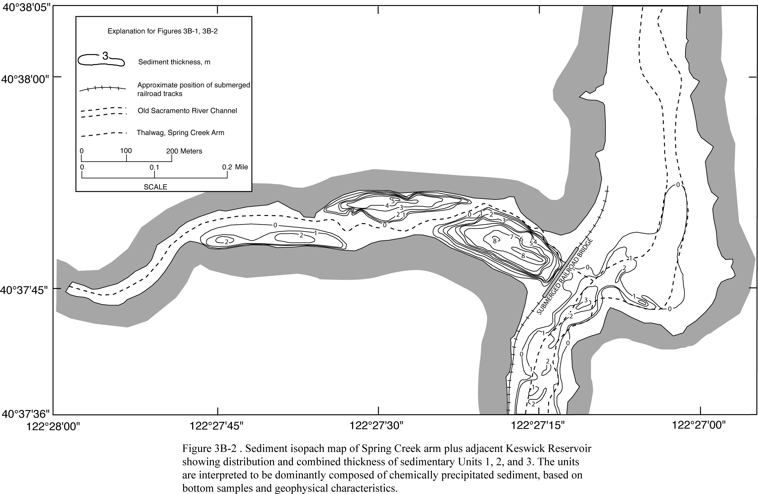
Figure 3B-2. Sediment isopach map of Spring Creek arm and adjacent Keswick Reservoir showing
distribution and combined thickness of sedimentary Units 1, 2, and 3. The units are interpreted to
be dominantly composed of sediment chemically precipitated from acid-mine drainage, based on
bottom samples and geophysical characteristics. The three main sediment accumulations are in the
Spring Creek Arm, with thicknesses reaching 2 m in the western accumulation, 5 m in the central
accumulation and 8 m in the eastern accumulation adjacent to the submerged railroad bridge. Up to
3 m has accumulated in the old river channel in Keswick Reservoir.
View full-size image (160 Kb)
|
|
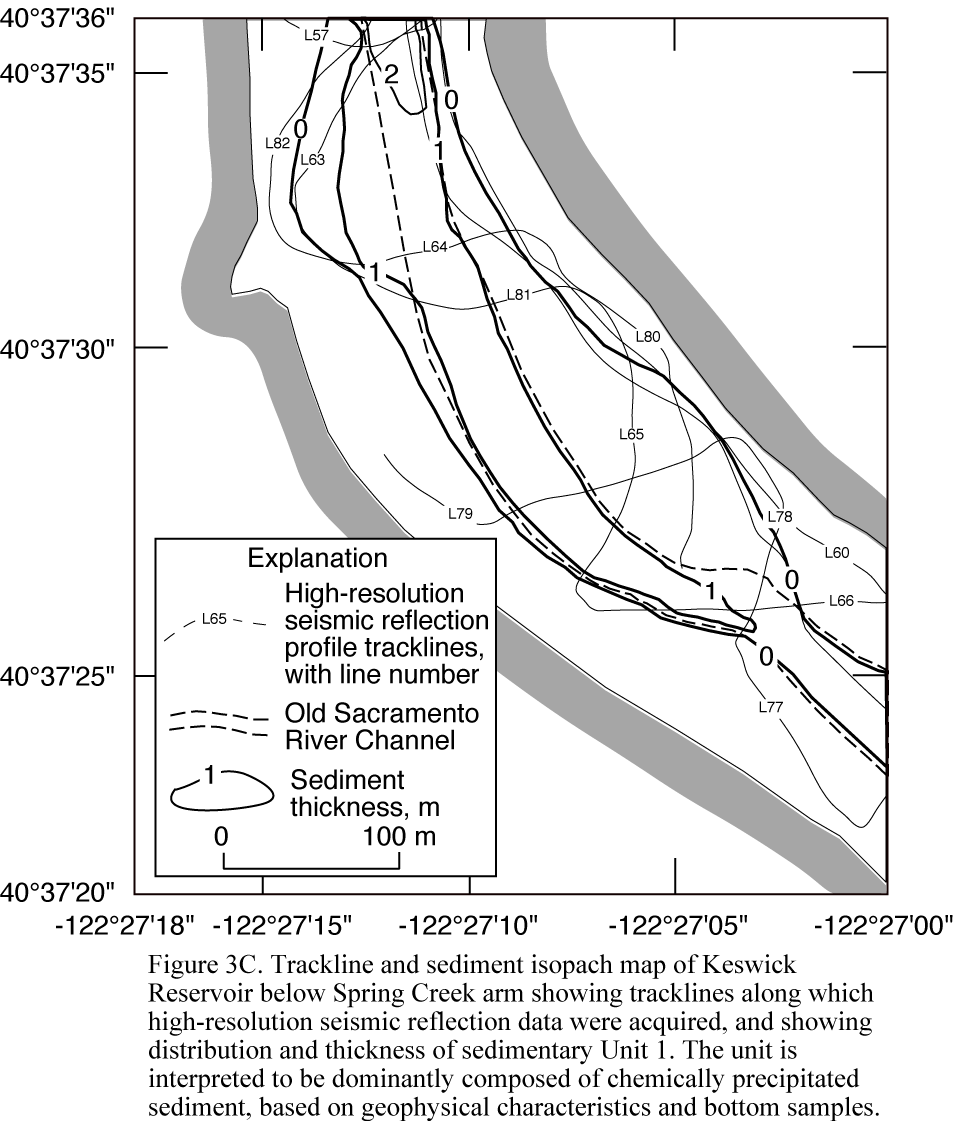
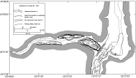
Figure 3C. Trackline and sediment isopach map of Keswick Reservoir below Spring Creek Arm showing
tracklines along which high-resolution seismic reflection data were acquired, and showing distribution
and thickness of sedimentary Unit 1. The unit is interpreted to be dominantly composed of sediment
chemically precipitated from acid-mine drainage, based on geophysical characteristics and bottom
samples.
View full-size image (88 Kb)
|

|
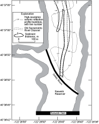
Figure 3D. Trackline and sediment isopach map of lower Keswick Reservoir showing tracklines along
which high-resolution seismic-reflection data were acquired, and showing area within which Unit 1
can be mapped, with unit thickness of less than 1 m. The unit is interpreted to be dominantly
composed of sediment chemically precipitated from acid-mine drainage, based on geophysical
characteristics and bottom samples.
View full-size image (100 Kb)
|
|
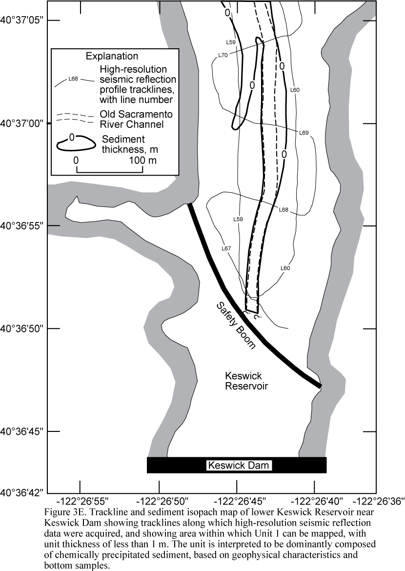
Figure 3E. Trackline and sediment isopach map of lower Keswick Reservoir near Keswick Dam
showing tracklines along which high-resolution seismic reflection data were acquired, and
showing area within which Unit 1 can be mapped, with unit thickness of less than 1 m. The
unit is interpreted to be dominantly composed of sediment chemically precipitated from acid-mine
drainage, based on geophysical characteristics and bottom samples.
View full-size image (72 Kb)
|
|
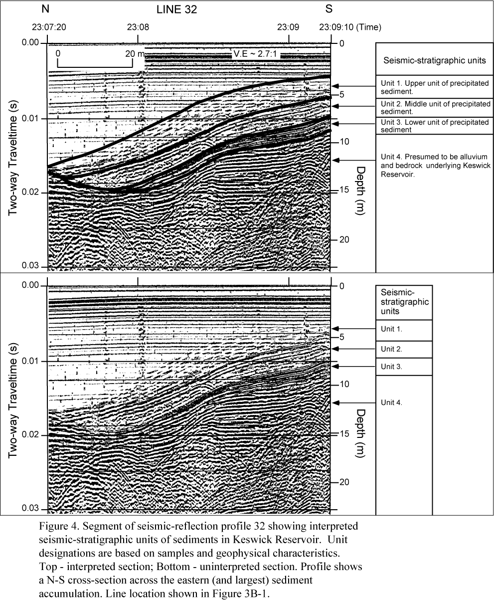
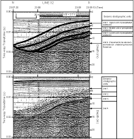
Figure 4. Segment of seismic-reflection profile 32 showing interpreted seismic-stratigraphic units
of sediments in Keswick Reservoir. Unit designations are based on samples and geophysical
characteristics. Top - interpreted section; Bottom - uninterpreted section. Profile shows a N-S
cross-section across the eastern (and largest) sediment accumulation. Line location shown in
Figure 3B-1.
View full-size image (216 Kb)
|
|
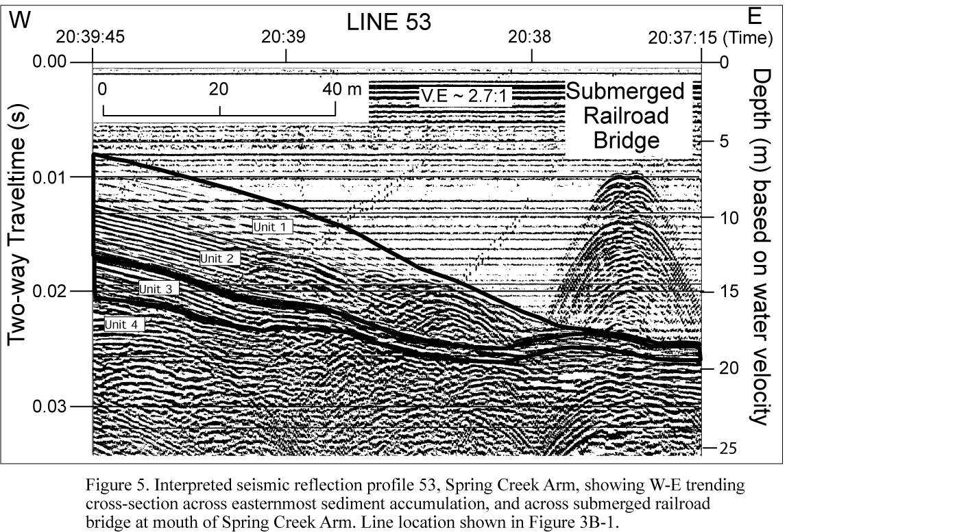
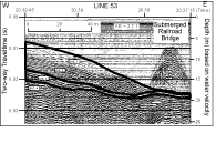
Figure 5. Interpreted seismic-reflection profile 53, Spring Creek Arm, showing W-E trending
cross-section across easternmost sediment accumulation, and across submerged railroad bridge
at mouth of Spring Creek Arm. Line location shown in Figure 3B-1.
View full-size image (168 Kb)
|

|
Figure 6. Interpreted seismic-reflection profile 37, trending W-E across old Sacramento River channel
in Keswick Reservoir. Line location shown in Figure 3B-1.
View full-size image (108 Kb)
|
For more information contact: