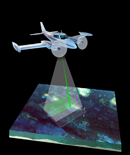
USGS-NPS-NASA EAARL Topography

LIDAR Illustration

Home Button

Purpose Link

PDF Maps Link

Raw Data Link

ArcMap Documents Link

Metadata Link

Collaborators Link


Metadata


Each raster or vector GIS file on this CD includes an FGDC compliant XML metadata file. These are easily viewed using the metadata tab under ESRI ArcCatalog, or in a web browser such as Microsoft Internet Explorer. In addition, links to general metadata for the four major data layers can be found below.


Lidar GeoTIFF

TXT - complete FGDC-compliant metadata


Contour lines shapefile

TXT - complete FGDC-compliant metadata


Hillshade grid

TXT - complete FGDC-compliant metadata


Tile Extent shapefile

TXT - complete FGDC-compliant metadata


Accessibility FOIA Privacy Policies and Notices

Take Pride in America home pageFirstGov LinkU.S. Department of the Interior | U.S. Geological Survey
URL: http://pubsdata.usgs.gov/pubs/of/2007/1178/HTML/metadata.html
For more information, contact: Feedback
Maintained by Publishing Service Center
Page Last Modified: Wednesday, 07-Dec-2016 20:41:27 EST