
Open-File Report 2007-1366
Sidescan-Sonar Imagery and Surficial Geologic Interpretations of the Sea Floor in Central Rhode Island Sound
![]() Title |
Introduction |
Geologic Setting |
Data Acquisition/Processing |
Bathymetry |
Seismic Reflection Data |
Sidescan Sonar Imagery |
Environments |
Discussion |
Summary |
GIS Data Catalog |
Acknowledgments |
References |
Figures |
Contacts
Title |
Introduction |
Geologic Setting |
Data Acquisition/Processing |
Bathymetry |
Seismic Reflection Data |
Sidescan Sonar Imagery |
Environments |
Discussion |
Summary |
GIS Data Catalog |
Acknowledgments |
References |
Figures |
Contacts
 |
||
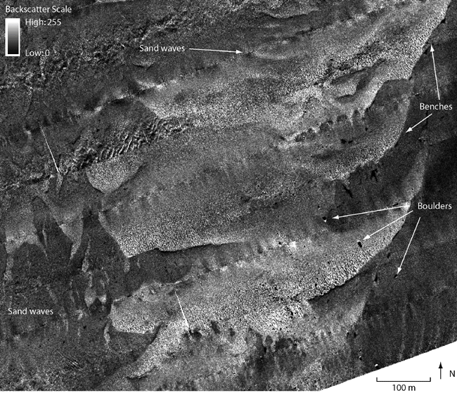
Figure 13. Detailed sidescan-sonar image of the southeastern part of the study area showing boulders, sand waves, and benches. Boulders are visible as high-backscatter targets with low-backscatter shadows. Higher backscatter (lighter tones) in the center of the image represents coarser grained sediment; lower backscatter (darker tones) represents finer grained sediment. Location of figure shown in fig. 2. | ||

![]() U.S. Department of the Interior |
U.S. Geological Survey
U.S. Department of the Interior |
U.S. Geological Survey
URL: http://pubsdata.usgs.gov/pubs/of/2007/1366/html/fig13.html
Page Contact Information: GS Pubs Web Contact
Page Last Modified: Thursday, 05-Dec-2024 15:14:11 EST

