U.S. Geological Survey Open-File Report 2007-1382
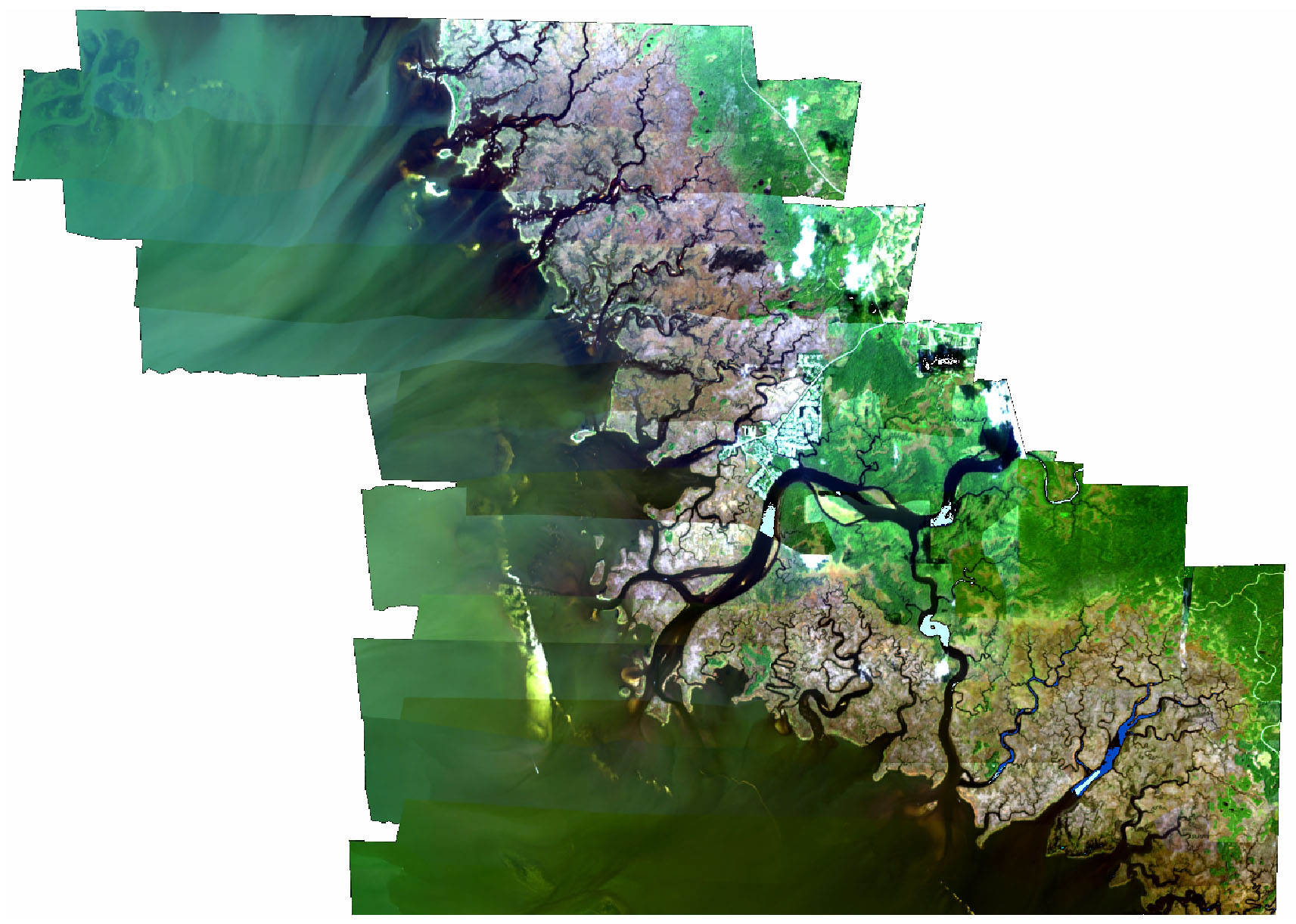
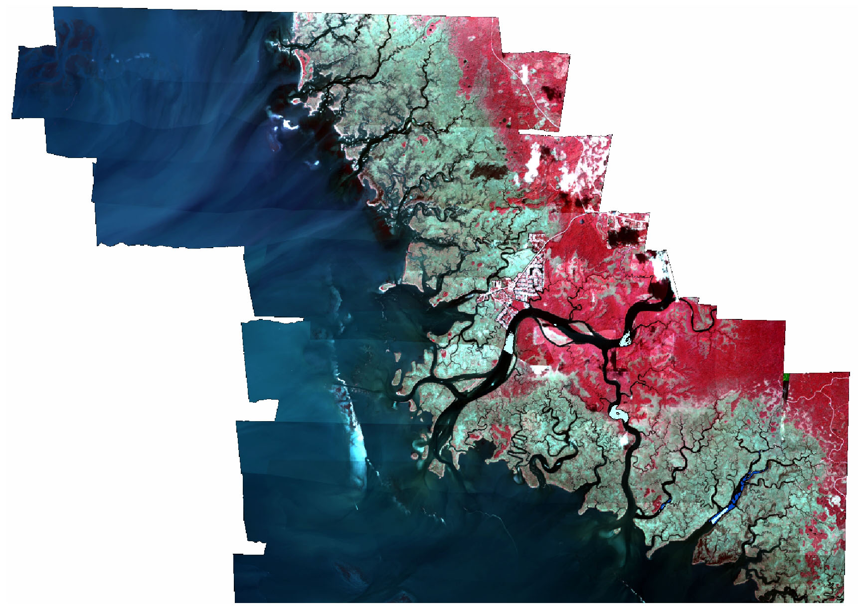
The U.S. Geological Survey conducted a pilot integrated-science study during 2002 and 2003 to map, describe, and evaluate benthic and emergent habitats in the Suwannee River Estuary on the Gulf Coast of Florida. Categories of aquatic, emergent, and terrestrial habitats were determined from hyperspectral imagery and integrated with hydrologic data to identify estuarine fish habitats. Maps of intertidal and benthic habitat were derived from 12-band, 4-m resolution hyperspectral imagery acquired in September 2002. Hydrologic data were collected from tidal creeks during the winter of 2002-03 and the summer-fall of 2003. Fish were sampled from tidal creeks during March 2003 using rivulet nets, throw traps, and seine nets. Habitat characteristics, hydrologic data, and fish assemblages were compared for tidal creeks north and south of the Suwannee River. Tidal creeks north of the river had more shoreline edge and shallow habitat than creeks to the south. Tidal creeks south of the river were generally of lower salinity (fresher) and supported more freshwater marsh and submerged aquatic vegetation. The southern creeks tended to be deeper but less sinuous than the northern creeks. Water quality and inundation were evaluated with hydrologic monitoring in the creeks. In-situ gauges, recording pressure and temperature, documented a net discharge of brackish to saline groundwater into the tidal creeks with pronounced flow during low tide. Groundwater flow into the creeks was most prominent north of the river. Combined fish-sampling results showed an overall greater abundance of organisms and greater species richness in the southern creeks, nominally attributed a greater range in water quality. Fish samples were dominated by juvenile spot, grass shrimp, bay anchovy, and silverside. The short time frame for hydrologic monitoring and the one-time fish-sampling effort were insufficient for forming definitive conclusions. However, the combination of hyperspectral imagery and hydrologic data identified a range of habitat characteristics and differences in tidal-creek morphology. This endeavor related nearshore benthic habitat and hydrologic conditions with habitat suitability and fish assemblages and provides a template for similar applications in shallow and nearshore estuarine environments.
 |
 |
This DVD publication was prepared by an agency of the United States Government. Although these data have been processed successfully on a computer system at the U.S. Geological Survey, no warranty expressed or implied is made regarding the display or utility of the data on any other system, or for general or scientific purposes, nor shall the act of distribution imply any such warranty. The U.S. Geological Survey shall not be held liable for improper or incorrect use of the data described and (or) contained herein. Reference herein to any specific commercial product, process, or service by trade name, trademark, manufacturer, or otherwise does not constitute or imply its endorsement, recommendation, or favoring by the United States Government or any agency thereof. Maps included in this publication can not be used for navigation.
Publications are available from USGS Information Services, Box 25286, Federal Center, Denver, CO 80225-0046 (telephone 1-888-ASK-USGS; e-mail: infoservices@usgs.gov).

![]() U.S. Department of the Interior |
U.S. Geological Survey
U.S. Department of the Interior |
U.S. Geological Survey
URL:http://pubsdata.usgs.gov/pubs/of/2007/1382/html/home.html
Page Contact Information: Web team
Page Last Modified:Wednesday, 07-Dec-2016 20:31:10 EST