Open-File Report 2008-1181
![]() Title |
Introduction |
Geologic Setting |
Data Acquisition/Processing |
Bathymetry |
Seismic-Reflection Data |
Sidescan-Sonar Imagery |
Environments |
Sea-Floor Geology |
Summary |
GIS Data Catalog |
Acknowledgments |
References Cited |
Figures |
Contacts
Title |
Introduction |
Geologic Setting |
Data Acquisition/Processing |
Bathymetry |
Seismic-Reflection Data |
Sidescan-Sonar Imagery |
Environments |
Sea-Floor Geology |
Summary |
GIS Data Catalog |
Acknowledgments |
References Cited |
Figures |
Contacts
 |
||
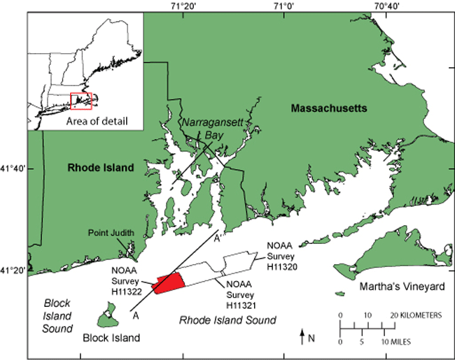
Figure 1. Location of National Oceanic and Atmospheric Administration (NOAA) survey H11322 study area (red polygon) in Rhode Island Sound, southeast of Point Judith, Rhode Island. Also shown are locations of NOAA surveys H11320 and H11321 and the seismic profile A-A' presented in figure 3. Inset shows location of study area off the northeastern United States. | ||

![]() U.S. Department of the Interior |
U.S. Geological Survey
U.S. Department of the Interior |
U.S. Geological Survey
URL: http://pubsdata.usgs.gov/pubs/of/2008/1181/html/fig1.html
Page Contact Information: GS Pubs Web Contact
Page Last Modified: Friday, 26-Aug-2022 08:34:20 EDT
