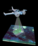
USGS-NPS-NASA EAARL Topography

LIDAR Illustration

Home Link

Purpose Link

pdf Maps Link

Raw Data Link

ArcMap Document-Current page

Metadata Link

Collaborators Link

ArcMap Documents


This DVD includes an ArcMap document for easy access to the merged Lidar topography product and contour lines. ArcMap version 9 (or higher) software and a valid license file are required. The Lidar GeoTIFFs are very large and may require more processing time.

If you encounter problems with the following links, please launch ArcMap and open the  "5M_merge.mxd" file from either the be_mosaic or fs_mosaic subdirectory located in the maps subdirectory on this DVD.


Accessibility FOIA Privacy Policies and Notices

Take Pride in America home page USA Gov LinkU.S. Department of the Interior | U.S. Geological Survey
URL: [DVD Drive]:\html\arcmap_doc.html
Page Contact Information: Feedback
Page Last Modified: October 14, 2008 (LJT)