U.S. Geological Survey Open-File Report 2009–1003
Digital Seismic-Reflection Data from Eastern Rhode Island Sound and Vicinity, 1975–1980
|
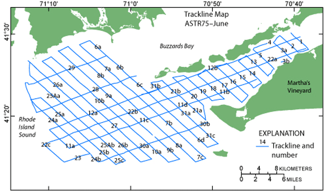
ASTR75–June Trackline Navigation The trackline map below (fig. 4) shows the locations of seismic data (lines 1-31) that were collected aboard the R/V Asterias in eastern Rhode Island Sound during 1975.
Figure 4. Map of tracklines from cruise ASTR75–June in eastern Rhode Island Sound. The navigation files for the seismic data are provided in space-delimited text and ESRI shapefile formats; the trackline data are in ESRI shapefile format, and each file includes metadata. All navigation data are available through the GIS Data Catalog section of this report. |

![]() U.S. Department of the Interior |
U.S. Geological Survey
U.S. Department of the Interior |
U.S. Geological Survey
URL: https://pubsdata.usgs.gov/pubs/of/2009/1003/html/eris_nav.html
Page Contact Information: Contact USGS
Page Last Modified: Wednesday, 07-Dec-2016 22:15:50 EST