U.S. Geological Survey Open-File Report 2009-1031
Vibracore, Radiocarbon, Microfossil, and Grain-Size Data from Apalachicola Bay, Florida
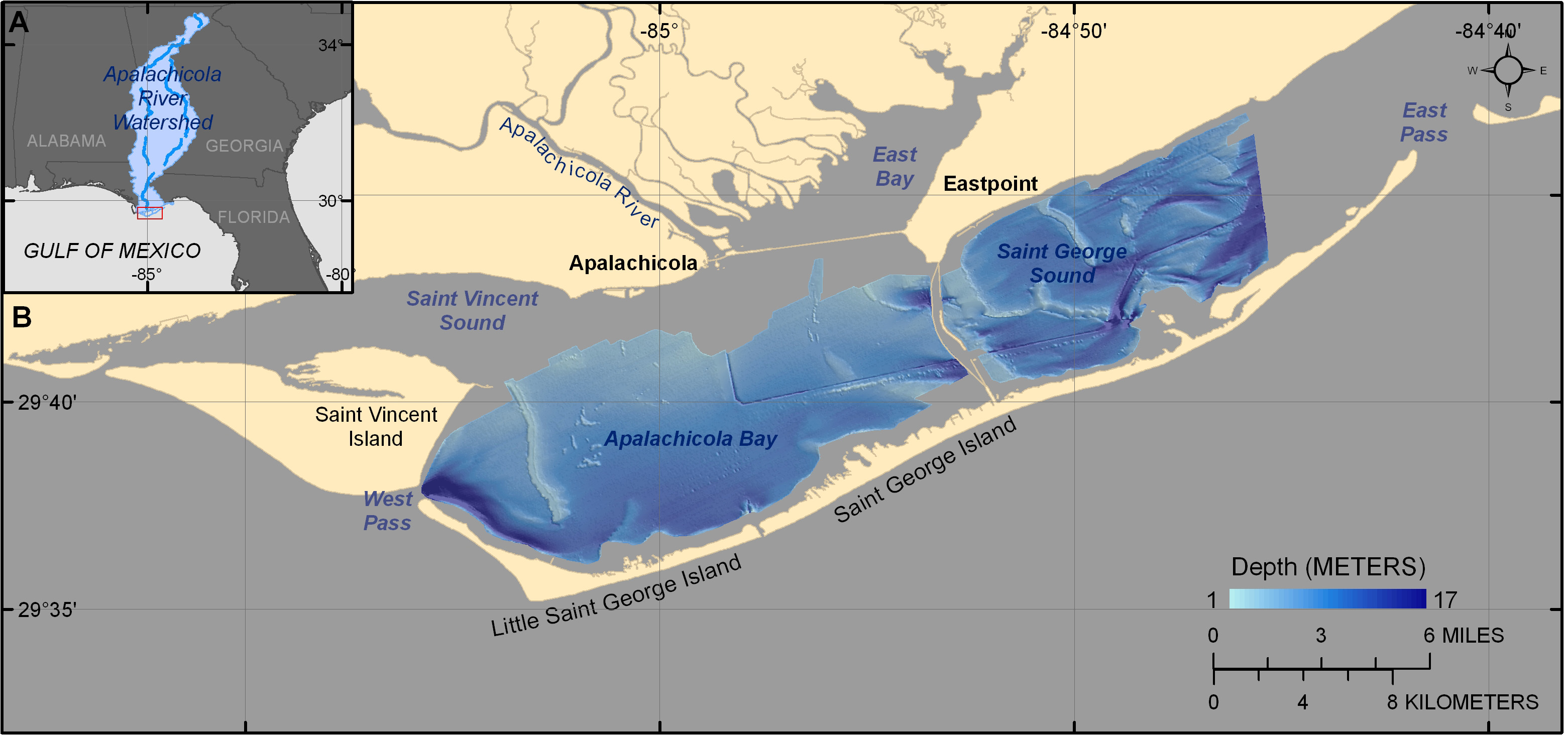 |
| Figure 1. (A) Inset map of the Florida Bight and Panhandle region including surrounding portions of Alabama and Georgia. (B) Apalachicola Bay is protected from the Open Gulf of Mexico by three barrier islands: Little Saint George Island, Saint George Island, and Saint Vincent Island. |

![]() U.S. Department of the Interior |
U.S. Geological Survey
U.S. Department of the Interior |
U.S. Geological Survey
URL: https://pubsdata.usgs.gov/pubs/of/2009/1031/html/imagepages/fig1.html
Page Contact Information: Contact USGS
Page Last Modified: Wednesday, 07-Dec-2016 22:15:19 EST
