U.S. Geological Survey Open-File Report 2009-1031
Vibracore, Radiocarbon, Microfossil, and Grain-Size Data from Apalachicola Bay, Florida
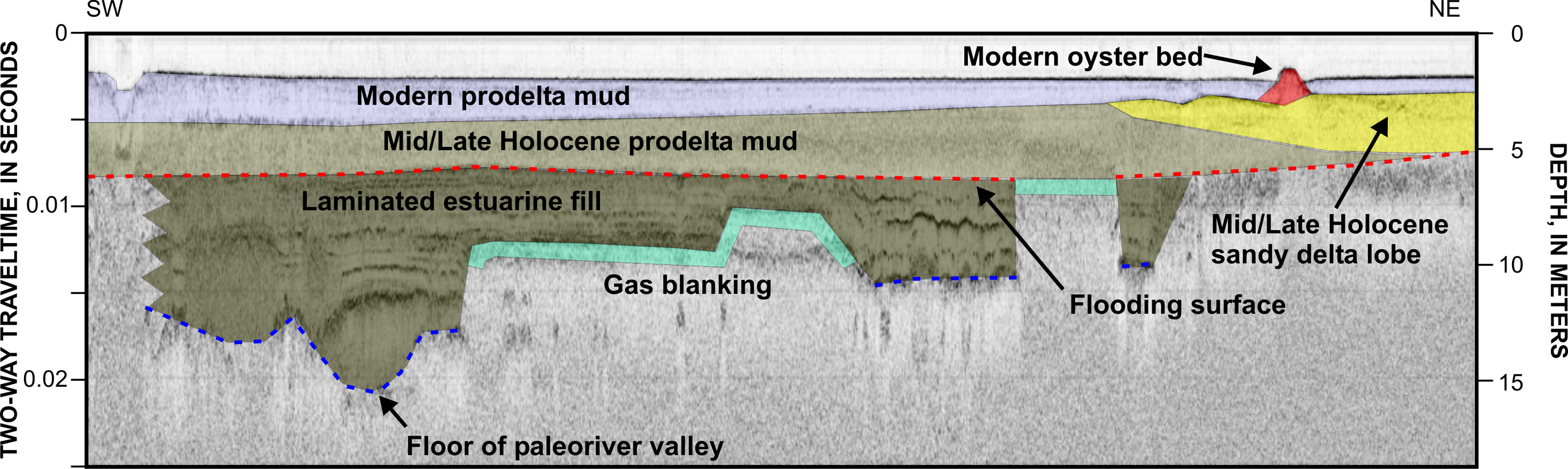 |
| Figure 3. Interpreted seismic profile showing the stratigraphic intervals underlying Apalachicola Bay. The deepest horizon imaged is the floor of a Pleistocene paleovalley. This valley was filled during the Early and Middle Holocene by estuarine deposits (modified from Twichell and others, 2007). |

![]() U.S. Department of the Interior |
U.S. Geological Survey
U.S. Department of the Interior |
U.S. Geological Survey
URL: https://pubsdata.usgs.gov/pubs/of/2009/1031/html/imagepages/fig3.html
Page Contact Information: Contact USGS
Page Last Modified: Wednesday, 07-Dec-2016 22:15:21 EST
