U.S. Geological Survey Open-File Report 2009-1072
Geophysical and Sampling Data from the Inner Continental Shelf: Duxbury to Hull, Massachusetts
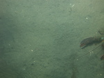
Click on an image below for a higher resolution image.
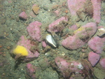
 dl2_PICT0287.JPG Station # 089 Lat 42.150455 Long -70.608761 Time(UTC) 22:51:08 |
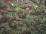
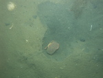
 dl2_PICT0288.JPG Station # 089 Lat 42.150582 Long -70.6086 Time(UTC) 22:51:44 |
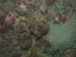
 dl2_PICT0289.JPG Station # 089 Lat 42.15075 Long -70.608401 Time(UTC) 22:52:34 |
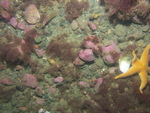
 dl2_PICT0290.JPG Station # 089 Lat 42.150901 Long -70.608249 Time(UTC) 22:53:13 |
 dl2_PICT0291.JPG Station # 089 Lat 42.151176 Long -70.607965 Time(UTC) 22:54:26 |
|||
 dl2_PICT0292.JPG Station # 089 Lat 42.151421 Long -70.60773 Time(UTC) 22:55:33 |
 dl2_PICT0293.JPG Station # 090 Lat 42.15054 Long -70.627284 Time(UTC) 23:12:52 |
 dl2_PICT0294.JPG Station # 090 Lat 42.150592 Long -70.627352 Time(UTC) 23:14:49 |
 dl2_PICT0295.JPG Station # 090 Lat 42.150655 Long -70.627467 Time(UTC) 23:15:32 |
 dl2_PICT0296.JPG Station # 090 Lat 42.150705 Long -70.627663 Time(UTC) 23:16:11 |
|||
 dl2_PICT0297.JPG Station # 090 Lat 42.150822 Long -70.627848 Time(UTC) 23:16:49 |
 dl2_PICT0298.JPG Station # 090 Lat 42.150903 Long -70.627916 Time(UTC) 23:17:22 |
 dl2_PICT0299.JPG Station # 090 Lat 42.150963 Long -70.628051 Time(UTC) 23:18:02 |
 dl2_PICT0300.JPG Station # 090 Lat 42.15103 Long -70.628156 Time(UTC) 23:18:31 |
 dl2_PICT0301.JPG Station # 090 Lat 42.151138 Long -70.628277 Time(UTC) 23:19:18 |
|||
 dl2_PICT0302.JPG Station # 090 Lat 42.151163 Long -70.628329 Time(UTC) 23:19:35 |
 dl2_PICT0303.JPG Station # 090 Lat 42.151231 Long -70.628483 Time(UTC) 23:20:19 |
 dl2_PICT0304.JPG Station # 090 Lat 42.1513 Long -70.628595 Time(UTC) 23:20:51 |
 dl2_PICT0305.JPG Station # 090 Lat 42.151325 Long -70.62872 Time(UTC) 23:21:23 |
 dl2_PICT0306.JPG Station # 090 Lat 42.151379 Long -70.628823 Time(UTC) 23:21:45 |
|||
 dl2_PICT0307.JPG Station # 091 Lat 42.146777 Long -70.640038 Time(UTC) 23:33:42 |
 dl2_PICT0308.JPG Station # 091 Lat 42.14681 Long -70.639938 Time(UTC) 23:34:03 |
 dl2_PICT0309.JPG Station # 091 Lat 42.146861 Long -70.639786 Time(UTC) 23:34:37 |
 dl2_PICT0310.JPG Station # 091 Lat 42.146932 Long -70.639553 Time(UTC) 23:35:31 |
 dl2_PICT0311.JPG Station # 091 Lat 42.146995 Long -70.639345 Time(UTC) 23:36:19 |
|||
 dl2_PICT0312.JPG Station # 091 Lat 42.14705 Long -70.639163 Time(UTC) 23:37:01 |
 dl2_PICT0313.JPG Station # 091 Lat 42.147071 Long -70.639082 Time(UTC) 23:37:20 |
 dl2_PICT0314.JPG Station # 091 Lat 42.147111 Long -70.638958 Time(UTC) 23:37:51 |
 dl2_PICT0315.JPG Station # 091 Lat 42.147156 Long -70.638836 Time(UTC) 23:38:20 |
 dl2_PICT0316.JPG Station # 091 Lat 42.147203 Long -70.638704 Time(UTC) 23:38:48 |
|||
 dl3_PICT0002.JPG Station # 092 Lat 42.142678 Long -70.669867 Time(UTC) 00:02:31 |
 dl3_PICT0003.JPG Station # 092 Lat 42.142698 Long -70.669856 Time(UTC) 00:03:42 |
 dl3_PICT0004.JPG Station # 092 Lat 42.14291 Long -70.669823 Time(UTC) 00:04:41 |
 dl3_PICT0005.JPG Station # 092 Lat 42.143102 Long -70.669793 Time(UTC) 00:05:32 |
 dl3_PICT0006.JPG Station # 092 Lat 42.143367 Long -70.669772 Time(UTC) 00:06:37 |
|||
 dl3_PICT0007.JPG Station # 092 Lat 42.143568 Long -70.669746 Time(UTC) 00:07:34 |
 dl3_PICT0008.JPG Station # 092 Lat 42.14372 Long -70.669724 Time(UTC) 00:08:16 |
 dl3_PICT0009.JPG Station # 092 Lat 42.143814 Long -70.669711 Time(UTC) 00:08:39 |
 dl3_PICT0010.JPG Station # 092 Lat 42.143878 Long -70.669698 Time(UTC) 00:08:59 |
 dl3_PICT0011.JPG Station # 092 Lat 42.144033 Long -70.669695 Time(UTC) 00:09:37 |
|||
 dl3_PICT0012.JPG Station # 092 Lat 42.144164 Long -70.669656 Time(UTC) 00:10:19 |
 dl3_PICT0013.JPG Station # 092 Lat 42.14432 Long -70.669647 Time(UTC) 00:11:01 |
 dl3_PICT0014.JPG Station # 092 Lat 42.144443 Long -70.669621 Time(UTC) 00:11:34 |
|||||


