U.S. Geological Survey Open-File Report 2009-1072
Geophysical and Sampling Data from the Inner Continental Shelf: Duxbury to Hull, Massachusetts
Click on an image below for a higher resolution image.
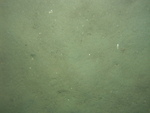
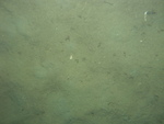
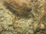
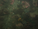
 dl3_PICT0015.JPG Station # 093 Lat 42.153767 Long -70.655988 Time(UTC) 00:24:34 |
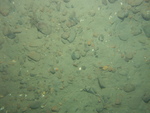
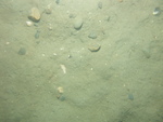
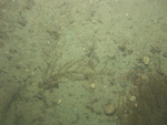
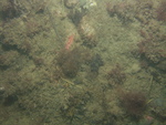
 dl3_PICT0016.JPG Station # 093 Lat 42.153832 Long -70.655823 Time(UTC) 00:25:10 |
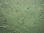
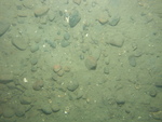
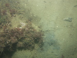
 dl3_PICT0017.JPG Station # 093 Lat 42.153927 Long -70.655566 Time(UTC) 00:26:08 |
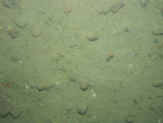
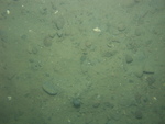
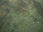
 dl3_PICT0018.JPG Station # 093 Lat 42.154019 Long -70.655324 Time(UTC) 00:27:03 |
 dl3_PICT0019.JPG Station # 093 Lat 42.154134 Long -70.655028 Time(UTC) 00:28:09 |
|||
 dl3_PICT0020.JPG Station # 093 Lat 42.154194 Long -70.654867 Time(UTC) 00:28:44 |
 dl3_PICT0021.JPG Station # 093 Lat 42.154246 Long -70.65473 Time(UTC) 00:29:13 |
 dl3_PICT0022.JPG Station # 093 Lat 42.154388 Long -70.654395 Time(UTC) 00:30:28 |
 dl3_PICT0023.JPG Station # 094 Lat 42.158064 Long -70.667032 Time(UTC) 00:42:56 |
 dl3_PICT0024.JPG Station # 094 Lat 42.158108 Long -70.666945 Time(UTC) 00:43:21 |
|||
 dl3_PICT0025.JPG Station # 094 Lat 42.158211 Long -70.666715 Time(UTC) 00:44:23 |
 dl3_PICT0026.JPG Station # 094 Lat 42.158291 Long -70.666555 Time(UTC) 00:45:04 |
 dl3_PICT0027.JPG Station # 094 Lat 42.158384 Long -70.666371 Time(UTC) 00:45:48 |
 dl3_PICT0028.JPG Station # 094 Lat 42.158484 Long -70.666173 Time(UTC) 00:46:38 |
 dl3_PICT0029.JPG Station # 094 Lat 42.158584 Long -70.665993 Time(UTC) 00:47:24 |
|||
 dl3_PICT0030.JPG Station # 094 Lat 42.158657 Long -70.665867 Time(UTC) 00:47:58 |
 dl3_PICT0031.JPG Station # 094 Lat 42.158766 Long -70.665673 Time(UTC) 00:48:54 |
 dl3_PICT0032.JPG Station # 095 Lat 42.15788 Long -70.694143 Time(UTC) 01:08:41 |
 dl3_PICT0033.JPG Station # 095 Lat 42.157888 Long -70.694131 Time(UTC) 01:09:12 |
 dl3_PICT0034.JPG Station # 095 Lat 42.158 Long -70.694092 Time(UTC) 01:10:09 |
|||
 dl3_PICT0035.JPG Station # 095 Lat 42.158312 Long -70.694088 Time(UTC) 01:11:15 |
 dl3_PICT0036.JPG Station # 095 Lat 42.158337 Long -70.694046 Time(UTC) 01:11:36 |
 dl3_PICT0037.JPG Station # 095 Lat 42.158513 Long -70.694026 Time(UTC) 01:12:23 |
 dl3_PICT0038.JPG Station # 095 Lat 42.158854 Long -70.693927 Time(UTC) 01:14:04 |
 dl3_PICT0039.JPG Station # 095 Lat 42.159095 Long -70.693867 Time(UTC) 01:15:16 |
|||
 dl3_PICT0040.JPG Station # 095 Lat 42.159506 Long -70.693797 Time(UTC) 01:17:22 |
 dl3_PICT0041.JPG Station # 095 Lat 42.159661 Long -70.693782 Time(UTC) 01:18:10 |
 dl3_PICT0042.JPG Station # 095 Lat 42.159715 Long -70.693784 Time(UTC) 01:18:32 |
 dl3_PICT0043.JPG Station # 096 Lat 42.170193 Long -70.697997 Time(UTC) 01:31:53 |
 dl3_PICT0044.JPG Station # 096 Lat 42.170235 Long -70.697772 Time(UTC) 01:33:11 |
|||
 dl3_PICT0045.JPG Station # 096 Lat 42.1703 Long -70.69762 Time(UTC) 01:34:20 |
 dl3_PICT0046.JPG Station # 096 Lat 42.170457 Long -70.697323 Time(UTC) 01:36:08 |
 dl3_PICT0047.JPG Station # 096 Lat 42.170495 Long -70.697253 Time(UTC) 01:36:32 |
 dl3_PICT0048.JPG Station # 096 Lat 42.170518 Long -70.697217 Time(UTC) 01:36:45 |
 dl3_PICT0049.JPG Station # 096 Lat 42.170573 Long -70.697113 Time(UTC) 01:37:24 |
|||
 dl3_PICT0050.JPG Station # 096 Lat 42.170674 Long -70.696914 Time(UTC) 01:38:37 |
 dl3_PICT0051.JPG Station # 096 Lat 42.170701 Long -70.696866 Time(UTC) 01:38:57 |
||||||


