Open-File Report 2010–1058
ABSTRACT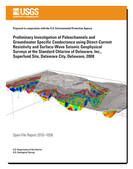
The U.S. Geological Survey (USGS), in cooperation with Region III of the U.S. Environmental Protection Agency (USEPA) and the State of Delaware, is conducting an ongoing study of the water-quality and hydrogeologic properties of the Columbia and Potomac aquifers and the extent of cross-aquifer contamination with benzene; chlorobenzene; 1,2-dichlorobenzene; 1,4-dichlorobenzene; and hydrogen chloride (hydrochloric acid when dissolved in water) in the vicinity of the Standard Chlorine of Delaware, Inc. (SCD), Superfund Site, Delaware City, Delaware. Surface geophysical surveys and well data were used to identify and correlate low-permeability units (clays) across the site and to search for sand and gravel filled paleochannels that are potential conduits and receptors of contaminated groundwater and (or) Dense Non-Aqueous Phase Liquid (DNAPL) contaminants. The combined surveys and well data were also used to characterize areas of the site that have groundwater with elevated (greater than 1,000 microsiemens per centimeter) specific conductance (SC) as a result of contamination. The most electrically conductive features measured with direct-current (DC) resistivity at the SCD site are relatively impermeable clays and permeable sediment that are associated with elevated SC in groundwater. Many of the resistive features include paleochannel deposits consisting of coarse-grained sediments that are unsaturated, have low (less than 200 microsiemens per centimeter) SC pore water, or are cemented. Groundwater in uncontaminated parts of the Columbia aquifer and of the Potomac aquifer has a low SC. Specific-conductance data from monitoring wells at the site were used to corroborate the DC-resistivity survey results. For comparison with DC-resistivity surveys, multi-channel analysis of surface wave (MASW) surveys were used and were able to penetrate deep enough to measure the Columbia aquifer, which is known to have elevated SC in some places. MASW survey results respond to solid material stiffness; clays and cemented sediments will have a higher velocity than silts, sands, and gravels (in order of increasing hydraulic conductivity). Geophysical surveys detected elevated SC associated with contamination of the surficial Columbia aquifer. Groundwater with elevated SC over ambient (by an order of magnitude) produced a decrease in measured resistivity at the SCD site. Where SC data are not available from wells, it is not known if a low resistivity value measured with DC resistivity alone results from the geologic material (clay) or elevated SC in groundwater (in sand or gravel). Seismic surface waves used as part of the MASW technique are not affected by water content or quality and are used herein to distinguish between sand and clay when SC is high. Through concurrent interpretation of MASW and DC-resistivity surveys, information was gained about water quality and lithology over large areas at the SCD site. |
First posted May 12, 2010 For additional information contact: Part or all of this report is presented in Portable Document Format (PDF); the latest version of Adobe Reader or similar software is required to view it. Download the latest version of Adobe Reader, free of charge. |
Degnan, J.R., and Brayton, M.J., 2010, Preliminary investigation of paleochannels and groundwater specific conductance using direct-current resistivity and surface-wave seismic geophysical surveys at the Standard Chlorine of Delaware, Inc., Superfund Site, Delaware City, Delaware, 2008: U.S. Geological Survey Open-File Report 2010–1058, 27 p., at https://pubs.usgs.gov/of/2010/1058/.
Acknowledgements
Abstract
Introduction
Site Description
Purpose and Scope
Hydrogeologic Setting
Methods of Surface Geophysical Data Collection and Analysis
Direct-Current Resistivity
Multi-Channel Analysis of Surface Waves
Paleochannels and Groundwater Specific Conductance
Results of Geophysical Surveys, Paleochannels and Relation to Groundwater Specific Conductance
Direct-Current Resistivity
Multi-Channel Analysis of Surface Waves
Paleochannels and Groundwater Specific Conductance
Summary
References Cited
Appendix 1. Direct-Current Resistivity Cross Sections with nearby Well Water Levels, Screened Intervals, and Specific Conductance Values

![]() U.S. Department of the Interior |
U.S. Geological Survey
U.S. Department of the Interior |
U.S. Geological Survey
[an error occurred while processing this directive]
URL: https://pubsdata.usgs.gov
Page Contact Information: Contact USGS
Page Last Modified: Wednesday, 07-Dec-2016 22:32:59 EST
